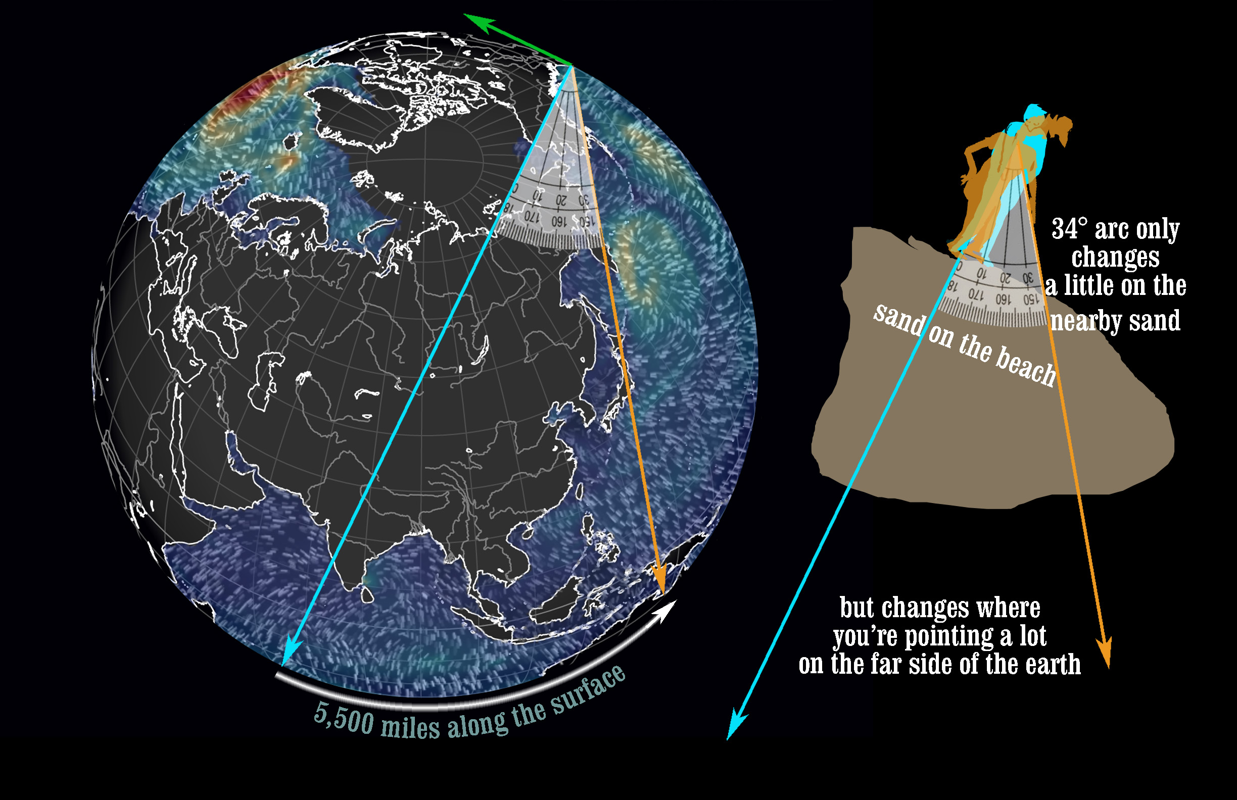
How much of the earth is covered with the Pacific Ocean? It’s big. If you stand at San Francisco’s Ocean Beach and want to point to the far shore of the ocean, you could point out to sea. 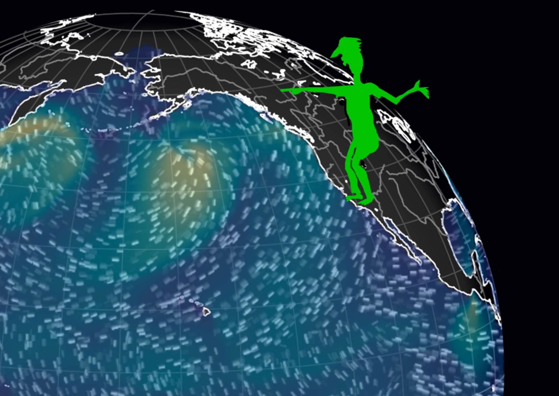
But we can think of it another way. To point through the globe to the far shore, you’d point to the sand one stride ahead of you. The Pacific is that big. You could reasonably say it goes almost all the way to the other side of the world.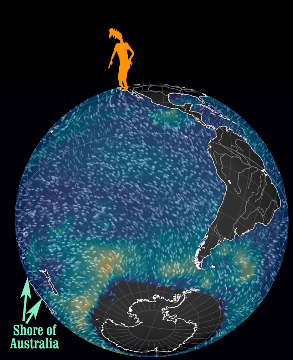
If you are, say, five-foot-eight and have average feet, you’d point to a spot two and a half feet (30 inches) ahead of your toes (while facing the surf and keeping your arm straight). Try it.
Assuming you’ll face west-by-southwest, it is true even if you aren’t right on the shore, say, from your house in Dogpatch. The minimal difference in your SF location compared to the size of the earth will only change the spot on the other side of the Pacific by the same few miles. Still pretty much the same jagged shoreline of Australia, the far side of the Pacific. G’day mate.
If you instead point straight down, you’ll be pointing toward the exact opposite side of the world, in the Indian Ocean.
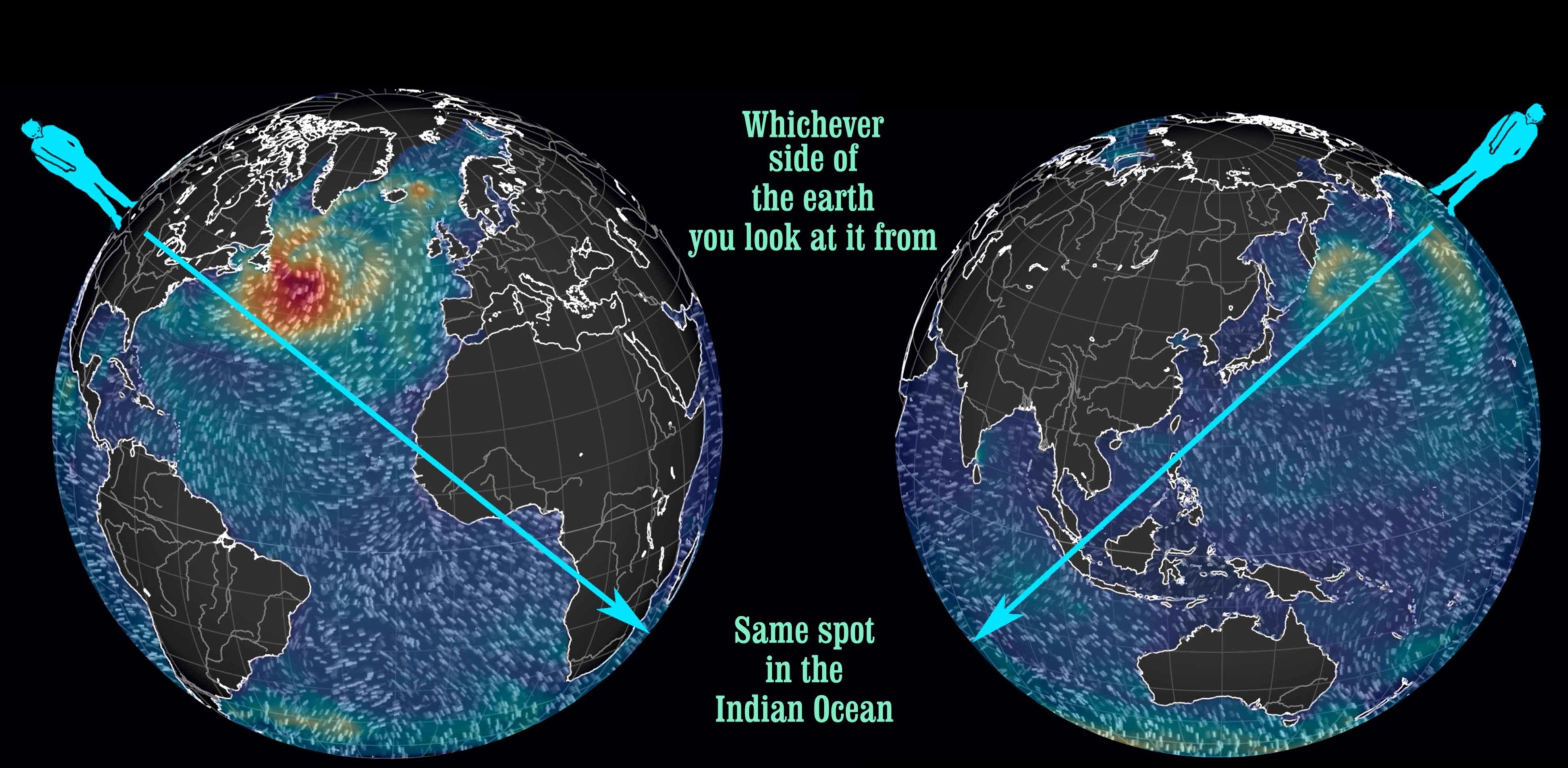
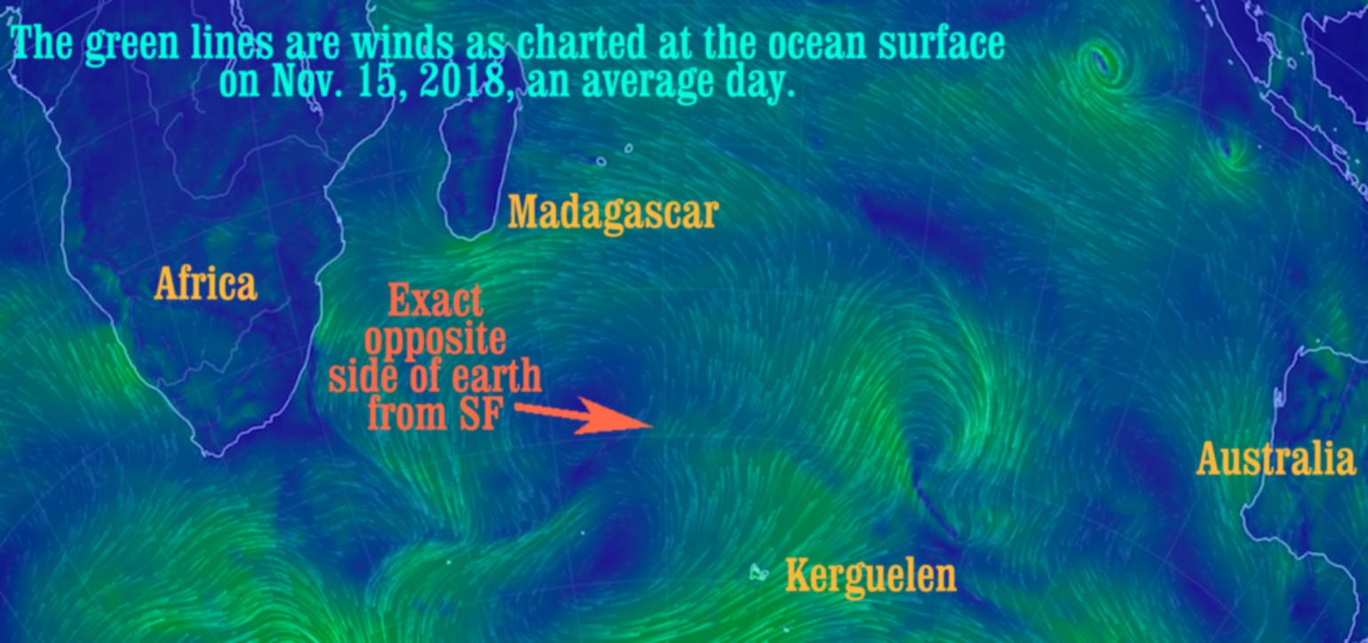
The precise other side of the world from San Francisco (12,436.81 miles from Market & Van Ness) is right between Madagascar and the rather smallish, southerly island of Kerguélen (French). These two islands are 2,000 miles apart. It’s a very stormy sea around there. So you’d better imagine a decent boat before you think yourself to that spot.
But now I’m wondering Why is San Francisco located at Van Ness and Market? Used to be that the “location” of San Francisco was in UN Plaza. Let’s go there!
You can see a giant gray stone X with brass cross hairs and big brass latitude and longitude numbers denoting the spot. It has all been embedded on the ground near the UN Plaza Fountain since 1975 when the plaza was set up to commemorate the creation and signing of the UN Charter, here in SF.
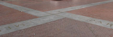
While you’re at this spot, turn and look at the fountain with the granite slabs. Those piles of stone were designed to represent the continents in the oceans. The original fountain scheme had tides, too. Broke after just a few months, I’m told.
Why was precisely that spot the location of SF? Why isn’t it anymore? It was in front of City Hall! You remember the one: It collapsed in 1906.

The previous SF City Hall as seen from Market at 8th. It fell in 1906. Earthquake. Apparently things break around here.
Atlases and charts based their intercity distances on city halls, for eons. Google Maps, however, uses the south corner of Market and Van Ness Streets instead. With everything at an angle to cardinal directions, it really is the south corner.
Two things have changed since 1906. City hall moved and print gave way to…Google. Weird world where a private company gets to change the official location of San Francisco without anyone asking them to (as far as I know).
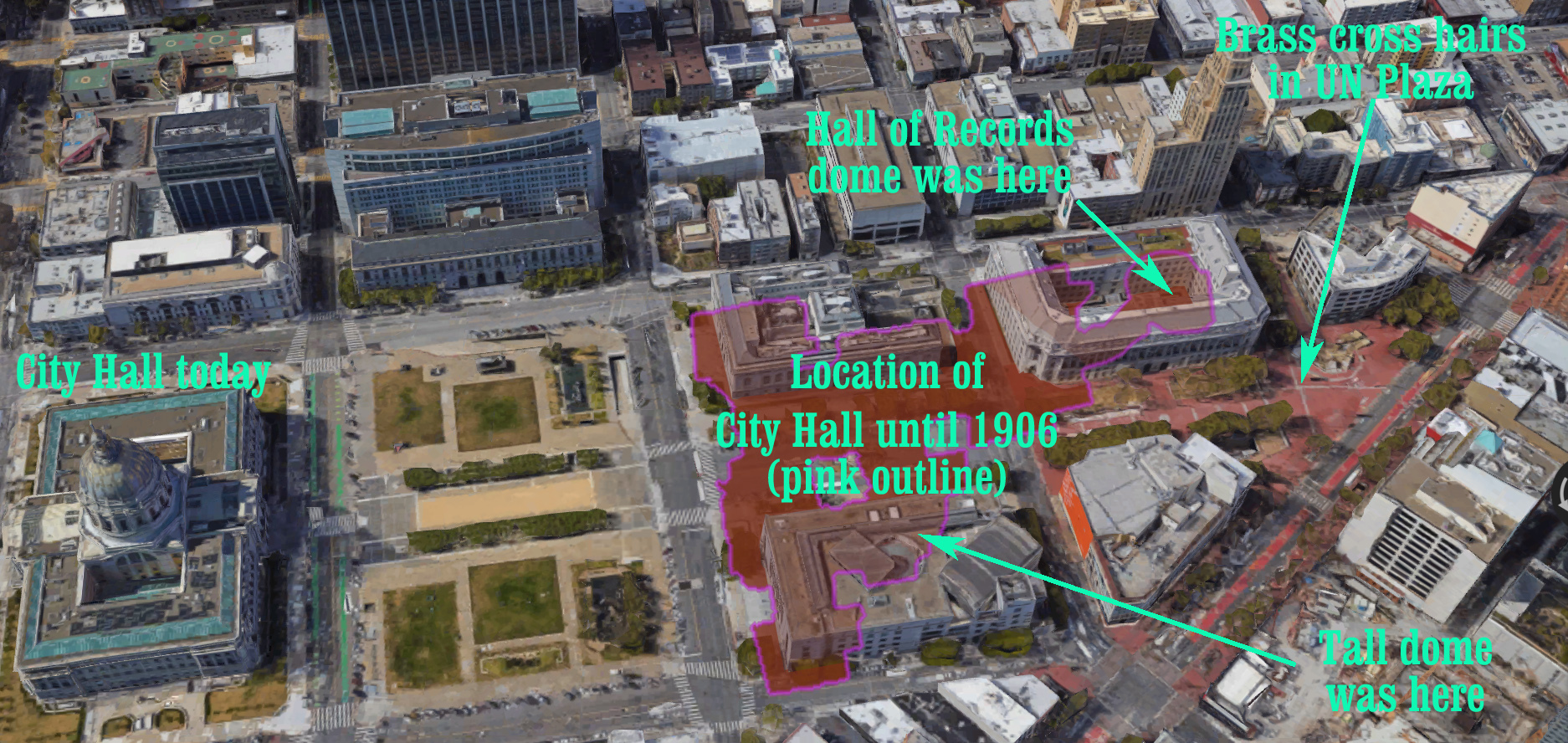
I don’t really know why the cross hairs are not precisely where the front steps of the old city hall were. I suppose it must be that the correct location was taken up by the old-old federal building or by the rest of the UN memorial, where it quotes from the charter. Go read the quotes and cry. The world isn’t following it very well.
But back to the Pacific Ocean.
For purposes of mind-traveling the other side of Earth, moving your body around the city is not as effective as moving your arm. Moving the angle of your pointing arm (from straight-down—the blue line) back to pointing one step ahead (the orange line) only moves 30-or-so inches on the ground near you. But since you’re moving your arm through a 34° angle, it shifts the spot you’re pointing towards, on the other side of the world, about 5,500 miles farther east along the surface (therefore closer to us). Australia.
Next article: In the pacific Pacific
Previous article: Albino Ladybug Lays Eggs…On Me