It was an easy sea day, like a swimming pool. Pacific, in fact. So quiet, we could hear leaping anchovies at 50 yards! They sounded and looked like rain.
It’s been almost 38 years since I arrived in SF. Thanks to Joanna McClure, I finally got a chance, August 9th, to take a natural history field trip to the Farallones islands!
A couple dozen people went, led by the nature education superstar Michael Ellis. In another first, I got to hang out with him a bit. I can now confirm that he’s profoundly knowledgeable and eerily quick. You may know him from Bay Nature magazine or KQED.
We saw a basking ocean sunfish (cartoony), a blue shark (also lazing) and three separate feeding frenzies with all manner of hungry beasts gobbling anchovies, by the swarm. The islands were interesting up close. It was so calm we could have stepped ashore easily, but we didn’t land (only researchers & coast guard allowed). The island area had multiple pinniped species and puffins dancing (the farthest south they nest). Did you know that the reason Brandt’s cormorants stayed out of the Egg Wars was that their whites are unappetizing by virtue of not being white? They stay clear after cooking!
The sea life changed as we went far beyond, to the deep ocean west of the continental shelf. The upwelling delivers food for critters from all across the ocean. We saw an albatross visiting from three thousand miles out. We even saw a blue whale, until recently thought to be the largest creature ever to have lived on earth!
Ah, whales. A couple decades ago in Key West, as part of a rescue team for a stranded infant whale, I got a chance to find out what a wee (about 40″ long) whale feels like. Warm. Smooth. Like a (human) baby, really. She was a pygmy sperm whale, which are very rarely seen at sea but strand uncommonly often. She grew well and survived a few months in captivity but died in a freak accident.
But I digress. So I may as well tell you that the only other time I’ve gone out in the Gulf of the Farallones, there were 40-foot swells crashing the bow in the Potato Patch shoals and washing down the entire length of the ship deck. What a contrast. What a relief.
Whale passing southward in front of Mount TamalpaisArch on the south Farallones island
How much of the earth is covered with the Pacific Ocean? It’s big. If you stand at San Francisco’s Ocean Beach and want to point to the far shore of the ocean, you could point out to sea.
But we can think of it another way. To point through the globe to the far shore, you’d point to the sand one stride ahead of you. The Pacific is that big. You could reasonably say it goes almost all the way to the other side of the world.
If you are, say, five-foot-eight and have average feet, you’d point to a spot two and a half feet (30 inches) ahead of your toes (while facing the surf and keeping your arm straight). Try it.
Assuming you’ll face west-by-southwest, it is true even if you aren’t right on the shore, say, from your house in Dogpatch. The minimal difference in your SF location compared to the size of the earth will only change the spot on the other side of the Pacific by the same few miles. Still pretty much the same jagged shoreline of Australia, the far side of the Pacific. G’day mate.
If you instead point straight down, you’ll be pointing toward the exact opposite side of the world, in the Indian Ocean.
The precise other side of the world from San Francisco (12,436.81 miles from Market & Van Ness) is right between Madagascar and the rather smallish, southerly island of Kerguélen (French). These two islands are 2,000 miles apart. It’s a very stormy sea around there. So you’d better imagine a decent boat before you think yourself to that spot.
But now I’m wondering Why is San Francisco located at Van Ness and Market? Used to be that the “location” of San Francisco was in UN Plaza. Let’s go there!
You can see a giant gray stone X with brass cross hairs and big brass latitude and longitude numbers denoting the spot. It has all been embedded on the ground near the UN Plaza Fountain since 1975 when the plaza was set up to commemorate the creation and signing of the UN Charter, here in SF.
While you’re at this spot, turn and look at the fountain with the granite slabs. Those piles of stone were designed to represent the continents in the oceans. The original fountain scheme had tides, too. Broke after just a few months, I’m told.
Why was precisely that spot the location of SF? Why isn’t it anymore? It was in front of City Hall! You remember the one: It collapsed in 1906.
The previous SF City Hall as seen from Market at 8th. It fell in 1906. Earthquake. Apparently things break around here.
Atlases and charts based their intercity distances on city halls, for eons. Google Maps, however, uses the south corner of Market and Van Ness Streets instead. With everything at an angle to cardinal directions, it really is the south corner.
Two things have changed since 1906. City hall moved and print gave way to…Google. Weird world where a private company gets to change the official location of San Francisco without anyone asking them to (as far as I know).
I don’t really know why the cross hairs are not precisely where the front steps of the old city hall were. I suppose it must be that the correct location was taken up by the old-old federal building or by the rest of the UN memorial, where it quotes from the charter. Go read the quotes and cry. The world isn’t following it very well.
But back to the Pacific Ocean.
For purposes of mind-traveling the other side of Earth, moving your body around the city is not as effective as moving your arm. Moving the angle of your pointing arm (from straight-down—the blue line) back to pointing one step ahead (the orange line) only moves 30-or-so inches on the ground near you. But since you’re moving your arm through a 34° angle, it shifts the spot you’re pointing towards, on the other side of the world, about 5,500 miles farther east along the surface (therefore closer to us). Australia.
All sorts of things happen, out exploring the city. This time what happened was yellow, squishy and nearly microscopic.
I’m deeply sorry I didn’t get a photo. The ladybug visitor was light brown and creamy white, similar to the one shown in the upper right of this stock photo. From what I find on the internet, this means it’s some sort of albino. But there’s a bit of a gap in the internet’s awareness of this topic, like so many that I have an interest in exploring.
When she landed on me, I was walking quickly homeward, about a mile remaining to my camera. I kept hoping the freeloader beautiful critter would stay passenging upon me until I got there. You see, the bug also had a second thing about it that appeared unusual: There was a tiny yellow blob on the side of it’s elytra (wing covering shell). I suspected it was an egg cluster, recently excreted.
It was my great luck that I hadn’t put contact lenses in. That would have made it hard to see such a small and close detail. It would have made it impossible. Even the type of bug might have been unclear to me with those magical devices upon my corneas. They prevent my looking closely, as great as they are for correcting my extreme vision. (I have severe near-sightedness, with -9.5 diopter contacts and -11.5 glasses.)
It turns out I chose well to wear glasses. By simply looking past the frame, scooted down my nose, I was able to employ my super power. High-detail close-up is my specialty—if I’ve left my contacts home. Back in college, when vinyl LPs were a thing, I was the one everybody brought their repair jobs to. I could see so well at two inches that a needle and a few seconds was all it took for me to reëstablish the proper grooves in a scratched Rubber Soul record—as good as new again.
After a few blocks, the ladybug settled into a cozy spot between two of my fingers. This gave me hope that it wasn’t angling to fly off. They usually climb to the highest point for that.
Just a few blocks left to go, and she seemed satisfied, patient, perhaps even a bit of a diva, awaiting the Klieg lights.
But then she crawled out into the open, took a few strides onto my thumb and began scraping the eggs from her back, side (not to be conflated with backside). She used her hind claw, rubbing until the blob had shifted onto my skin.
Since no photo, I thought the least I can do is provide you a look at the last Golden Gate Park bug that visited my hairy arm when I did have a camera.
At this point the translucent yellow mass was visibly separated into a few eggs, but even my fabled vision in direct sunlight was too weak to be able to count individual eggs. They were still in a tumbled heap on my skin—not a neat alignment of individual eggs attached on a leaf’s underside per the ladybug Rules of Standard Practice—when that infernal bug simply flew away, leaving me to care for her (attempted) progeny.
But I refused. With just four blocks left, I decided the eggs were better off in someone’s front yard succulents than in my apartment, striking poses for my camera. Without the perpetrator, it would have felt like a low attempt to catalog forensic evidence.
I suppose I could have sent a dog after her to head off her escape, but my vision’s not that bad. I’ve no dog.
Thus, I was left alone, in wonder. And then I remembered that I hadn’t used my explorer’s blog in a very long time.
I just learned more about why the project to get rid of the preggie test frogs has been failing. Which frogs? The African clawed frogs that live in Golden Gate Park in the Lily Pond. Apparently they were dumped there as a gesture of goodwill.
Back in the 50s rabbits were all the rage for pregnancy tests. A pregnant woman’s urine would cause the rabbit to ovulate. Problem was that you had to kill the rabbit to find the result. Then bufo marine toads and African clawed frogs were found to accomplish the same thing without the sacrificial ritual. Frogs ovulate externally!
So until the pee-on-a-stick test was developed, which directly senses the hormones in the urine, frogs were hanging out at medical labs doing their analytic good deeds. When they were phased out, the lab put them in the pond. All was well until a Myxophes faciolatus fungus came along from far continents.
This pathogen caused all the aquatic life except the clawed frogs (who are immune) to die of chytridiomycosis. Now those clawed frogs aren’t such welcome Park guests because they’re carriers. If they hoppity hop to other ponds–death to all! If you’ve been by the Lily Pond in the past couple years, you’ve seen bleach attacks and lime dumping to try and kill off the frogs along with their pal M. faciolatus.
I just got word that the frog can hybernate (and the eggs can survive drought) for five years. So much for that brutally easy fix. What will next happen in this strange tale?
———–
Reply from Eric Mills: New Year’s Day 2015 (via Jake Sigg)
Was pleased to see your post re: the African clawed frogs in GG Park’s Lily Pond. That population was discovered by personnel from the nearby Cal Academy of Sciences back in 2003. As noted, these non-native and prohibited frogs are notorious carriers of the dreaded chytrid fungus (Bd), thought to be responsible for the extinctions of some 200 frog and other amphibian species worldwide in recent years. It’s likely they were dumped in Lily Pond by researchers at nearby UCSF
Thus it was that our dysfunctional State Dept. of Fish & Game (now Fish & Wildlife–aren’t fish wildlife, too?) immediately jumped on the issue, and a clean-up was planned for the summer of 2003, a “seine and drain” affair, with all the frogs, tadpoles and eggs being strained and destroyed. (Lily Pond is a small former quarry, with a rock bottom, and no outlets, surrounded by hills.) A relatively simple job, yes? Yet only a few hours before the operation was to get underway, it was abruptly cancelled by a panicky DFG. Their reported excuse? They couldn’t guarantee that all the frogs would be caught and destroyed.
So for the past 12 years Lily Pond has been open to the public. Any kid with a dipnet could have dispersed this highly invasive species. Indeed, we have seen herons carry away live frogs. One live frog was discovered in the nearby AIDS Memorial Grove.
So the Dept. and the SF Rec & Parks have been dragging their collective feet all these years, interspersed with periodic and ineffective seining of the pond. I can hardly wait for the lawsuits, once these critters disperse, as they already likely have. There’s also a small population of threatened red-legged frogs in the nearby Arboretum.
I just finished famed biologist E.O. Wilson’s latest book, “THE MEANING OF HUMAN EXISTENCE,” in which he posits that the human species is “innately dysfunctional.” Hard to argue with that.
Meanwhile, our Dept. of Fish & Wildlife continues to import some TWO MILLION non-native bullfrogs into California every year for human consumption (mostly in the Chinatown live food markets, kept in horrendous conditions). Worse, the majority of the bullfrogs test positive for the chytrid fungus. Many are bought and released into local waters by “do-gooders” and religious sects for “animal liberation” ceremonies, where they prey upon and displace our native species, while spreading diseases, including the chytrid fungus. (The bullfrogs generally do not succumb to the disease, but they certainly do disperse it.)
PARTIAL FIX: The DFW could easily put a stop to the issuance of the frog/turtle import permits. They have the authority. Indeed, back in 2010 the Fish & Game Commission voted 5:0, instructing the Dept. to stop issuing import permits. Only weeks later the then-Director, John McCammon, announced he would continue the permits on a month-to-month basis. Challenged, the Dept. could only weakly respond, “The Director acts at the pleasure of the Governor.” Say What?! So much for the democratic process, while we continue to lose our native wildlife.
Write to the DFW and demand that these permits cease immediately: Chuck Bonham, Director, Dept. of Fish & Wildlife, 1416 Ninth Street, Sacramento, CA 95814; email – director@wildlife.ca.gov. The Secretary of Resources, John Laird, may be written at the same address, email – secretary@resources.ca.gov
———–
An earlier note from Jake Sigg to Bay Nature, regarding this article:
Your note in the October-December 2013 issue regarding African Clawed Frog and chytrid fungus gave the impression that the ACF’s days in Golden Gate Park are numbered. That is not correct. The issue has become embroiled in intra-agency infighting, and the dread scenario of this frog and its devastating chytrid fungus disease (to which ACF is immune) becoming at large in California is all too real. The interface between politics and biology is an exceedingly uncomfortable place to be, with the latter always losing.
Here’s my 7-minute storm video, meditative and exploratory rather than my usual strict documentation.
San Francisco was blasted by a few inches of rain in a single day on Thursday, Dec. 11, 2014. It was an ‘atmospheric river’ (AR) blasting at the coast like a fire hose. These “rivers” contain as much water as many Mississippis, wafting through the air about a mile above the sea from the equatorial region beyond Hawai’i.
This one first blasted Canada and then Washington, then Oregon, then us (in essEFF), then Southern California.
I’ve been researching the probable AR storm sequence of 1861 & 1862, as readers of this site will know, so I decided to go out and capture some images around town. It won’t appear especially dramatic to people from wetter climates, but the SF infrastructure and history of drought prepares us poorly us for this kind of thing.
My friend John’s offices (Stripe) at Folsom and 18th Street are so flood prone they moved all the furniture upstairs! Last time a storm like this came, it flooded the area four feet deep. But he was spared this time!
Music in this video is Aïya Aïya by Rachid Taha, who (quoting Wikipedia) is an Algerian singer and activist based in France. • Please support him and his brilliant work! •
If you want to help do research on the AR of 1862, please let us know!
Living in the Plate Boundary and Through the Ice Ages
Geologist and plate tectonics animator Tanya Atwater presented a talk with the title above to our Natural History Series talks at the Randall Museum October 16, 2014.
The presentation was largely based on diagrammatic animation videos which these notes cannot describe. But you can see them yourself on Atwater’s website (or you can Google ‘Atwater animations’). I wasn’t as able to take notes as thoroughly as usual since my eyes were up on the video screen a lot.
The surface of the earth is made of plates floating on (and diving down thousands [?] of miles into) the earth’s molten mantle, which is always flowing.
When we looked at the animation of the continents coming into their present formation, India seems to move faster than the rest. This is partly due to the size. Smaller means it can move faster. Of course the speeds are all pretty slow, taking many millions of years. (Speeds are similar to how quickly a fingernail grows, according to Julian Lozos’s talk on How Quakes Are Measured back in July.)
The Himalayas are uplift (crumpling and wrinkling of the plate that pushes the surface up). This is due to the direct-hit crunching of the Indian plate against the continental plate to its north.
The Pacific Plate is the largest plate, taking up almost 1/3 of the surface of the earth. It’s being dragged past the North American Plate to the NW, scraping against it and at the same time leaving bits behind along the edge.
[Background: Continents ride on higher plates than ocean plates. These are formed by uplift, by volcanos, by wind and glacial deposits, etc. The North American Plate is like this.]
The area west of North America has been for a long time (until recently) made up of three separate ocean plates. Ocean plates are formed by spreading mid ocean rifts where mantle magma wells up in the gap. The two plates on the east side of the rift zone have flowed under the Americas now (a process called ‘subduction’). There’s a tiny bit left of one (Juan de Fuca Plate) in Oregon and North California Coastal waters and a little (of the Farallones Plate) near Central America.
As the rift spreads, the Pacific Plate gets bigger on its east side faster than it moves northwest. That means it grows and seems to come closer while in fact it is moving away. The direction of movement is not directly away, but scraping NW along our coast, pulling our coast out and stretching the North American continent. That’s why the high areas that used to be Utah and Nevada had room to collapse and fall over becoming the basin and range provinces with lots of gaps between high ridges. In some places it pulls and other places it just recedes away from the North American Plate, depending on the local twists of the boundary. That is why the Gulf of California has opened up and why there was room for Santa Barbara and the Channel Islands to twist out of line.
The San Andreas
Tanya’s graduate thesis was to try and figure out the San Andreas Fault, which turns out to be a unique fault over the whole earth.
If a slipping fault is a perfect line in the direction of slip, it has no gaps that pull apart or places that push against each other (forming wrinkles, i.e. hills). But in reality, all places have some kinks and twists, so there are hills and gaps formed.
Pinnacles Park in California has a very identifiable kind of volcanic rock. Rocks the same have been found hundreds of kilometers away so we know that one side of the slipping fault moved from the Mojave area since the eruption.
Bodega Head has granite that has moved up from Southern California, 500 km, as do a few other spots on the Northern California coast.
About 25% of the motion of the fault’s energy is spread into the Tahoe region in smaller stress faults than the main ones on the coast. In 10 million years, those will probably break away and there will be an ocean alongside Las Vegas, because the Pacific Plate will have dragged what is now California away, probably. Tanya loves diagramming ‘the future’ because it’s entirely (and fun to) conjecture.
Subduction
Before the San Andreas, we had a subduction zone as the ocean rift pushed the two (now almost gone) plates under us. The mid ocean ridge where the spreading areas were is now mostly under our plate.
A subduction pretty much has to be along a straight line. When the subduction hits the melting point (not from friction but from the internal heat of the earth) it bubbles up through the plate above it. That is why there are volcanos in the Cascade Mountain Range. It’s the Juan De Fuca Plate coming back up. And those have lots of steam because the plate drags ocean water under along with the rocks. Some rising magma is trapped as magma, hardening before emerging and that becomes granite, cooled slowly so it has big crystals. Some of the melted crust makes it to the surface and is lava. That lava flowed to the coast and was crumbled and tossed into a mixer of rocks, alluvial soils, seawater, etc., some of which was dragged back down by the subduction to enter the whole cycle again and again. Meanwhile, some of the rubble of this cycle is left on the edge of the North American Plate. This is the ‘accretionary wedge.’
Other geographical features
The Great Valley (a.k.a Central Valley, San Joaquin Valley) is the collected debris of the volcanoes and cycles of subduction at the edge of the continent. The land west of it (the coast range) is the uplifted part of that debris (cause by bends in the slipping fault pushing mountains up) mixed with that melange of things dragged along from elsewhere. The melange is blue schist and chert from the seafloor (radiolarian skeletons) and all sorts of stuff.
The Transverse Ranges (Tehachapies) that curl toward the coast are granite like the Sierra Range, but the farther south you go the more deeply eroded away it is, so the farther under the formation you are looking. The granite in places like Joshua Tree Park are not smoothed into canyons like the Sierra’s bowl-shaped canyons because there were no glaciers to scrape and smooth them. They formed rounded boulders instead by their natural fracturing patterns.
The L.A. basin is deep and filled with mud.
Between Santa Barbara and San Diego there was a break and a gap opened. The land that was there got pulled and rotated. It is now the block of material that the Channel Islands and Santa Barbara sit on. It tumbled clockwise (as viewed from above) and was rotated to its current position by the two plates grinding past one another within a gap where the coast was pulled out allowing for rotation space. Geologists can tell this is so, even though it is unlikely, because the rocks formed with their magnetism lining up with the poles. Now the magnetism points east in all those areas, so they know by paleomagnetism studies that the whole section pulled apart and rotated.
Ice Age
The present sea level is about as it has been since the last ice age ended and stabilized 6,000 years ago. It’s melt from the ice age glaciers. The maximum of the ice age was about 17,000 years ago after tens of thousands of years of ice age that built up gradually and ended suddenly (as they do). We are now in an interglacial period. The previous one was about 100,000 years ago, and they happened in the past about every 100,000 years.
As the glaciers melt quickly, the sea level rises a lot. For the most recent, it rose between 300 and 400 feet all around the world at once. Each shore location where sea level remained a while, the wave action cut a terrace on the edge of the continent. By the time the sea level goes gradually down and then quickly back up the next time, the continent has risen some distance, so the next wave terrace is below the old ones. This eventually forms a stair-step coast line. The older steps are more eroded but they are highly visible even to the untrained eye.
If there is a lot of sand in the waves, it takes up the wave energy, but if not, the energy cuts new terraces.
There was so much more she said! That’s all I wrote about in my notes.
I was in a canyon in the Gold Country last weekend, at the Yuba River researching my usual, the storm of 1862. And going for a nice swim. The Bridgeport covered bridge has signs saying it was built to replace the one washed away by the storm.
I marveled at the beauty of the canyon, saw a sign about gold panning regulations and found myself singing, “In a cavern, in a canyon, excavating for a mine….” I suddenly wondered, Is this song about the flood!? Is this yet another clue to the severity and centrality of this storm sequence I’ve been studying? No, that would be too good. I’ve found cultural artifacts from the storm in a few places. It’s there in some mazurkas and waltzes from the 1860s which are dedicated to the floods…but nobody’s ever heard of them anymore. And in the opening scenes of Steinbeck’s East of Eden…but it’s not a very direct reference.
They’re easy to find in Bret Harte’s short stories, but nobody knows those stories anymore. The only one anyone has heard of, and few people at that, would be The Luck of Roaring Camp, published after the storm. It described a mining camp that’s inundated by a storm. The flood waters whisk away an infant. The kid, a prostitute’s baby that they took over parenting as a camp (all men; big scandal) when his mom died, is referred to by the miners as “The Luck.” Harte wrote other stories of people being plucked from treetops by passing boats, but those more literal references aren’t known in popular culture today, not even slightly.
I’m excited to report I was right about Clementine! At least the evidence looks really good.
My interest was piqued when I remembered that the song mentions her dad is a “49er.” It also describes Clementine drowning. Here’s the song. The following verses aren’t necessarily all original, but they may be. It was written as a parody and therefore invited later changes and additions.
(My Darling) Clementine by Percy Montrose (and maybe Barker Bradford)
1. In a cavern, in a canyon, excavating for a mine,
dwelt a miner, forty-niner, and his daughter Clementine. [data: California after the Gold Rush of 1849]
Chorus: Oh my darling, oh my darling, oh my darling Clementine,
thou art lost and gone forever, dreadful sorry, Clementine. [data: she’s dead]
2. Light she was and like a fairy, and her shoes were number nine,
herring boxes without topses, sandals were for Clementine.
(Chorus)
3. Walking lightly as a fairy, though her shoes were number nine,
Sometimes tripping, lightly skipping, lovely girl, my Clementine.
(Chorus)
4. Drove she ducklings to the water ev’ry morning just at nine,
stuck her foot against a splinter, fell into the foaming brine. [data: brine? seashore near high elevation mining areas? huh? Oh, and why do ducks need to be driven to the water? Strange ducks.]
(Chorus)
5. Ruby lips above the water, blowing bubbles mighty fine, but, alas, I was no swimmer, so I lost my Clementine. [data: definitely drowned]
(Chorus)
6. In a churchyard near the canyon, where the myrtle doth entwine,
There grow rosies and some posies, fertilized by Clementine [this verse, less commonly known, shows up a few places including here]
(Chorus)
7. Then the miner, forty-niner, soon began to peak and pine,
thought he oughter jine his daughter, now he’s with his Clementine.
(Chorus)
8. I’m so lonely, lost without her, wish I’d had a fishing line,
Which I might have cast about her, might have saved my Clementine. [this lesson about saving her overlaps in purpose with a later one]
(Chorus)
9. In my dreams she still doth haunt me, robed in garments, soaked in brine,
though in life I used to hug her, now she’s dead, I draw the line. [hilarious; data: that pesky brine again]
(Chorus)
10. Listen fellers, heed the warning of this tragic tale of mine,
Artificial respiration, could have saved my Clementine. [this 2nd ‘lesson’ verse is also less common, also shows up here]
(Chorus)
11. How I missed her! How I missed her! How I missed my Clementine!
But I kissed her little sister and forgot my Clementine.
[yeah yeah]
(Chorus)
You’ll see why I mention the lessons in a moment.
So how do I determine any reference to the 1862 storms? I looked up the history of the song. I was hoping it was written right after the flood. Nope. 1884—a whole generation later. But all sources agree that it was based on another song called Down By the River (Lived a Maiden) which was apparently written in 1863, right after the storm. Eureka! A good start. But how similar is the original song? The 1863 song by Henry S. Thompson has a similar plot with some identical phrases and characters. It was not sarcastic the way the well-known version is. It was, though, a aparody of sorts in that it was a minstrel mockery, sopping with the supposed unsophistication of the person singing it.
It ends with this pay dirt: “Don’t give your ladies too much rye wine, because like as not in this wet weather they’ll share the fate of Clementine.”
Well, actually, more precisely, the last stanza is
Now all young men by me take warning,
Don’t gib your ladies too much rye wine,
Kase like as not in this wet wedder,
Dey’ll share de fate ob Clementine.
Now, given this ultimate stanza, you see the reason for my focus on the ‘lesson’ verses in the sarcastic 1884 version: The original 1863 song ends with a lesson about storms, which seems to have stayed with the song in a modified form.
Look closely at that. It states clearly that the lesson, the very purpose of the song, is to address a rare phenomenon: death by accidental drowning due to wet weather. How often do people drown due to wet weather? Who would even think of drowning as a danger associated with wet weather?
At that moment in the public awareness, that horrible way of dying was commonplace—I know from my research. A song written right after hundreds did drown that way seems certain to be strong evidence. I can say with some certainty: It’s a direct reference to the storm!!!
In case anyone doubts that “wet weather” was a real storm reference, here’s another line in the original 1863 song: “de wind was blowing awful.” And the moment she dies she’s trying to drive the ducks back away from the river, the opposite of the 1884 version. Why would she try to keep her ducks away from the river? This question is just as valid as my earlier wondering why the ducks were being driven to the water! As it happens, it’s easier to answer. Possibly to prevent their being swept away. Witnesses, in their diaries, letters and also quoted in contemporary news accounts say the river currents in the storm tore thousands of bridges, ferries, mills, mill races, docks and landings out. It overflowed banks to scour the land of fences, crops, woodpiles, animals (both domestic and wild), plus a number of houses, businesses and even a handful of entire towns. This occurred up and down the west coast for many weeks. This wasn’t any old storm.
And the brine, what about the brine? In the original as I was able to find it, the first use of the term brine is: “Her lips were like two luscious beefsteaks, Dipp’d in tomato sauce and brine,” which is a pretty forced rhyme, or should I conveniently desalt it and say ‘rime’?
The second use of the term ‘brine’ later in the song, does, in sorrowful fact, appear in the original as, “She fell into the foamy brine.” This doesn’t dispense my problem, but I can weave a scenario in which it can be ignored! The author wrote the original from 1863 without sarcasm, as you’ll see when you read it in a moment. So maybe he was the lover who couldn’t swim! How would he know the difference between foamy brine and foamy raging waters of a disastrous flood? Um, since I don’t believe my own fantasy scenario there, let’s redirect your attention to the foam. Foam definitely connotes extreme water flow. (Standard sleight of hand technique I can use to make an inconvenient word disappear!) But seriously, I think the second use of the word ‘brine’ was another forced rhyme. See if you agree with me when you read the whole 1863 version at the end of this post.
In the 1863 version, the 49er is missing entirely. There’s no miner and no father. I need to track down precisely where it was written. And what ‘Digby pine’ is. (I feel I’ve heard the term but it hasn’t been so easy to track on the internet.) There are lots more bits of this story to track, even if the evidence is already strong. I want stronger!
With all the awkward lyrics and badly scanning syllables in the original (making a further mockery of the black-faced characters it was apparently meant to lampoon visually in the physical theater style), it begged for that 1884 rewrite. The sarcasm and silliness in the revised story was the point in the rewritten version, not the flood and not the “Black” sad-sack protagonist.
In the 1884 version, the most strainedly poetic part is: “But I kissed her little sister and forgot my Clementine.” And everyone singing it promptly forgot the original 1863 song when its little sister–the 1884 version–kissed them!
If that’s not enough hilarity for ya, the term “clement” was used (more in those days than now) to describe good weather! People still use officialeze ‘inclement weather’ today.
And now, finally, the whole of the original from 1863:
Down By the River (Lived a Maiden) by Henry S. Thompson
Down by the river there lived a maiden
In a cottage built just seven by nine,
And all around this lubly bower
The beauteous sunflower blossoms twine.
Chorus:
Oh! my Clema Oh! my Clema!
Oh! my darling Clementine,
Now you are gone and lost forever,
I’m drefful sorry, Clementine.
Her lips were like two luscious beefsteaks
Dipp’d in tomato sauce and brine,
And like the cashmere goatess covering
Was the fine wool of Clementine.
Her foot, Oh Golly! ‘Twas a beauty
Her shoes were made of Digby pine,
Two herring boxes without the tops on
Just made the sandals of Clementine.
One day de wind was blowing awful
I took her down some old rye wine,
And listened to de sweetest cooings
Ob my sweet sunflower Clementine.
De ducks had gone down to de riber,
To drive dem back she did incline,
She stubbed her toe and, Oh! Kersliver
She fell into the foamy brine.
I see’d her lips above de waters,
A blowing bubbles bery fine,
But ‘twant no use, I want no swimmer
And so I lost my Clementine.
Now ebry night down by de riber
Her ghostess walks bout half-past nine,
I know it’s her a kase I tracked her
And by de smell ’tis Clementine.
Now all young men by me take warning
Don’t gib your ladies too much rye wine,
Kase like as not in dis wet wedder
Dey’ll share de fate ob Clementine.
Okay, the original was sarcastic in some ways after all. But I’m not.
Do you realize how fun exploring is? It is for me! I just returned from a wildernessy road trip to places with no name. It was that remote. Okay, not as far away as my fantasy places to go canoeing on the Canadian Shield, but remote enough to stumble across artifacts which have been sitting untouched for longer than the West has been part of the USA.
If you want to see some pictures from that trip to NW Nevada and NE California, scroll down in this article. If you want to see a lot of pictures with a story spelled out in long captions, go to these links.
Here’s an image of the lighthouse back when it was more interesting. [only visible in full article]Once again, I get to bask in the glory of being wrong.
In my post to everyone on the Thinkwalks mailing list, twice, I said that a tunnel goes out to the Mile Rock Lighthouse.
I’ve learned I’m totally incorrect. It’s a sewer tunnel, not lighthouse access. I fabricated, without realizing it.
I feel 100% certain my contact at DPW told me that it goes to Mile Rock, which I may have assumed meant Mile Rock Lighthouse. I should always research more before sending to my audience, silly me. I was feeling rash and excited. And I misinterpreted, for sure. Mile Rock Beach, not Mile Rock, is the destination of that tunnel. I don’t know where I got the part about lighthouse access in storms. My brain hurts in a fun way.
[Next Day UPDATE] Turns out it’s also a chance to test the shape and speed of the rumor mill…
And an amazing speed it has! Whispers of the tunnel under the sea have already reached the far-off land of Marin County, where it’s rumored that the tunnel actually continues, hidden, through familiar hills right under the noses of local residents. Rash news reports also mention a continuation to the south, crossing the Mexican border! Rumors sure do fly.
I found this rare and out of print book of sketches by William Woollett from 1935. It includes a handful from the original construction of the Bay Bridge East Span. Since we’re celebrating an almost wondrous new structure there, I thought I’d make these available to everyone.
I don’t know how to use WordPress light box. So just click twice on each picture to see the enlarged version. Then use your browser’s back button to get to the next picture. Bad. Easier: They’re all together on my Flickr page.
William Woollett also did a book of sketches of Hoover Dam. The 1989 Capra Press (Santa Barbara) book that these sketches appeared in also includes the Golden Gate Bridge, San Diego sketches, Los Angles sketches, other San Francisco sketches, Hoover Dam, aqueducts, canals, missions and transmission lines. I guess he was into infrastructure.
Participants in many of my water walking tours have consistently told me I must go see the basement of the Armory.
I finally did!
The building’s current owner, porn company Kink.com, gives studio tours that include a brief visit to the sub-basement. There, where many channels of water flow in rough concrete trenches, they tell us we’re looking at Mission Creek.
They noted the tributary creek that once ran past their building, and acknowledged that they’re not right about Mission Creek. They seemed interested in making their presentation more accurate, though it’s a struggle to get every Kink.com guide on the same page.
I think I have a good solution for them that keeps the drama of mentioning Mission Creek in their spiel, at the same time increasing their accuracy.
Here’s the room with various cuts and trenches that have water seeping in from the surrounding soils.
It would be most accurate to say that the water in their sub-basement is groundwater that used to flow into Mission Creek.
Think of it like this: The area of the Armory from Valencia to Folsom was a wet marsh more than a creek, until lots of added fill dirt for building the city hemmed it in. The entire area within a block of the Armory is so saturated with groundwater that any basement this deep would have water flowing into it.
It’s inaccurate to say it’s Mission Creek. It’s probably just as inaccurate to say it’s the Mission Creek tributary called Old Arroyo Dolores, which is shown nearby on the map.
In the building it flows shallowly from east to west, while the water in the area overall flows west to east. This is because it is not technically any creek at all, but leaks seeping across the foundation slab.
It appears that the smaller channels were purposely created for accumulating water at the west end of the room.
So, it would be most accurate to say it’s groundwater that used to flow out Mission Creek to Mission Bay, before urban landfill destroyed those features.
Glad I finally got the full information I craved. All the photos I had previously seen left me wondering where the water went into and out of the basement. My video shows it all.
We tried to put the creek into our mural. Monasketched it on paper. Sethpainted it on the wall—three times before getting it the way he liked it, with the street names of the Wiggle bike route shimmering in the water. We carefully mocked reality with brown (Franciscan chert) rocks on the one side of the creek and green (serpentine) on the other side. We even allowed ourselves interpretive license when we colored it in crayon blues.
When we designed the mural (1996 & ’97) I was the information source on this old creek. But I got the main thing wrong: A creek didn’t flow in the places where the Wiggle goes.
I hereby recant (as I’m fond of doing) in great detail (as I’m also fond of doing).
I thought that the Wiggle follows an old creek bed. Half right! Only the part from Duboce to Market Street actually does. Sort of. The other part, north and west of Duboce Park, was so sandy that nothing flowed on the surface except during storms. Sand soaks up a lot of water.
The 1876 Humphreys map shows a guess at the original course, ignoring the diversion it suffered in the late 1700s. See! Maps lie. The green rectangle lyingly labeled HOSPITAL became Duboce Park.
Luckily for my half that was right, an actual creek did emerge at the base of the southernmost dune, right at Duboce Avenue (about where Sanchez is).
Here’s a rundown of what I now know about that creek.
Location
It flowed from a spring that emitted water absorbed by the dunefield. From there it flowed strongly across what is now Market Street at about Church Street. It went down 15th Street at the base of a cliff (since removed) near Dolores Street. Then it went over to 14th and entered a freshwater marsh, which in turn flowed into the tidal waterway called Mission Creek at 14th and Folsom, about where Rainbow Grocery is today.
The Creek’s Past
Before I address the tricky matter of its name, here’s the creek’s prehistory: Going back 10,000 years, it was the ice age and the dunefield hadn’t formed, yet. The bedrock valley that’s now buried in sand was an actual creekbed flowing all the way from Golden Gate Park down to the Mission District and into a river valley which existed where the Bay is. Starting about 5,000 years ago, a “village” called Chutchui was along the creek near Market. It was actually more of a campsite used during summers by Yelamu Ohlone indians.
The creek’s brief history: The strength of the spring was Captain Anza’s cue to locate the Mission just south of the dunes. They needed enough water to irrigate crops and orchards. The creek was channeled almost immediately. According to research by Christopher Richard, an irrigation ditch was dug to divert the creek southward from the source.
The couple hundred residents of Chutchui were conscripted as the first labor for the Franciscan padres who founded Mission Dolores. Indians were called “diggers” but probably not for their new pastime as ditchdiggers. More likely, it’s because they made baskets from rhizomes dug out of the creek banks.
The Creek Today
The January 1941 flood on Market Street. This was 31 years before the Muni Metro and 60 or so years before the vent was installed that acts as a drain into the station today.
Today, the creek flows in the ground, through fill soils and in the sewers. In storms, the creek returns. When the sewers fill, the water flows along the gutters. At least twice a decade, a bigger storm fills the whole street with water. A tunnel entrance at Duboce and a vent at Church and Market allow it into the subway—something designers may regret some day. The Muni Metro, at both the Van Ness and Church stations, closes for a few hours while the water gets pumped out again.
The Creek’s Future
Eventually, the pavement will wash away and the creek will return. Simple as that. Whether the creek is restored by design or by the caprices of extreme weather is up to us.
Help Name the Creek!
The case for ‘Dolores Creek’
The creek remains unnamed. Anza called it Dolores Spring (Ojo de Agua de los Dolores) because the day (in 1776) was the Feast of Sorrows (dolores). His geographer, Father Font, called the creek Dolores Creek (Arroyo Dolores) in his journal from the same expedition. We could simply use this name, except it would be confusing: Within months of Anza and Font, Father Palou (a geographic ignoramus) applied the name to another creek flowing where 18th Street is—and it stuck. Using ‘Dolores Creek’ would require also renaming the 18th Street creek.
The case for ‘San Souci Creek’
In the winter of 1861 to ’62, the largest storms ever recorded caused deep pools of water to collect in the dunefield. One covered 25 acres, in the Panhandle Park (which didn’t yet exist). When the sand gave way, slurry gushed furiously along the creek’s original bed. The deluge was so strong that it crushed Francois Pioche’s mansion to matchsticks. He was one of SF’s top financiers and his ill-fated L’Hermitage “guest cottage” was one of the few houses nearby at that time.
The popular (but incorrect) notion was that the floodwaters had come from a different over-filled lake: Sans (or San) Souci Lake was where the low part of Divisadero Street is now. It lapped the doorsills of the San Souci Roadhouse at what is now Fulton and Divisadero. As a result of this storied flood, the creek valley became known as Sans (or San) Souci Valley until at least 1920. The valley extended to the Panhandle and Lone Mountain. It was graded for roads and developed starting in the 1870s.
How my old flyer looked
Perhaps the creek should be called San Souci Creek, as I did on my early Thinkwalks flyers. I like that name because sans souci means carefree in French.
It was often spelled to match the San in ‘San Francisco’. Since someone saw fit to drop an ‘s’, I hope to drop an ‘e’ and make Carefree Valley into Carfree Valley someday! I predict spelling-wars if the creek is named San Souci.
The case for ‘Chutchui Creek’
When I pose the question of naming to folks on my walking tours, the consensus is often to name it for the Yelamu campsite. Sadly, I have little information about its location(s) and less about how we came to know the name.
Have another name for the creek?
Please contribute your comments and suggestions below!
My mom, Joan Straumanis, arrived home in DC just in time to feel the surprising 5.9 quake. It was the first earthquake she ever felt and she had this to say about it:
Where was I during the earthquake? In the bathroom at National Airport, just after returning from Boston. Many people around me were alarmed. But to be honest, I thought it was more exciting than frightening. It was actually sort of gentle, and different from what I had imagined: more rocking than shaking, and inspiring—to think of the earth as dynamic like that.
I stayed in the airport, thinking about aftershocks and the fact that I would be better off there than in either the Metro or my brick highrise building. When I finally decided to leave, the Metro was running slow (literally, 15 miles/hour) and was rush-hour crowded because so many office workers had been sent home. The fountain park near my house was packed with hundreds of people sitting on the benches or the grass, working on laptops, reading Kindles, or just sitting. Because it was a beautiful day? Or because they felt safer there?
I found some damage in my apt—pictures askew, vases and other small items knocked down, and my childhood globe thrown to the floor (so appropriate!). The delicate glass flowers I had carefully carried home without damage all the way from the Ukraine were broken. Nothing material lasts forever.
We are definitely silly to take this planet for granted. Humans and other species have had mostly a very hard time here over the eons, and even if we weren’t making a mess of it, we’d be up against a scary prospectus.
There were three times in my life that I felt a bodily sense of the massive, rumbling rock we live on: the 1989 Loma Prieta Quake; witnessing a roaring, glowing, lathery lava fountain on the Big Island of Hawai’i in the 90s; and the 2001 Leonid meteor showers. The meteor shower was almost as good as seeing the whole planet from space, like on my Earth Flag, and feeling its smallness.
I recorded my feelings about the Leonids in these four dense paragraphs, written shortly afterwards:
The meteor shower! The meteor shower! Wowoowowow it was amazing! After past attempts, I was pretty pessimistic about the chances for seeing a good show, but it was superb. Allison drove her powerful but very compact car with six of us to the ridge of Panoramic Highway on the way up to Mount Tam—the same place I went for the Perseid meteor showers in about 1996. There were so many people, not just the six in our tiny car but in other cars going up there, that the Marin cops were out directing traffic in the middle of nowhere at 1:45 in the morning. Traffic was backed up for miles and the mountain roads were lined with parked cars in every conceivably parkable spot.
Even on the way there we began to see, out the car windows, amazing streaks of light across the sky. By the time we plopped our tarp down and got under our blankets, we had already seen a dozen of ’em. Once were were lying down, the true spectacle was revealed, interspersed with the wackiest falling star humor (such as singing “100 Bottles of Beer on the Wall” but with stars and not knowing what number to start at, or discussing the difficulties Orion would have with his pants once the three bright stars of his belt fell off).
There were meteors every second or so—good, long, bright ones! The percentage of spectacular ones was very high (more than half) and the percentage with glowing tails was above 90%. Some were so intense, they seemed to explode and go out with a flash at the end of their streak. Others (very few) were dim and slow with no tail. I developed the hypothesis that the slow ones (going in all different directions) were the ones being just pulled in by gravity as the earth shot past them, while the fast-burners with glowing tails (all coming from the direction of Leo) were the ones the earth’s atmosphere slammed into head-on. It’s like the difference between the raindrops that hit you when you are sitting in the bed of the pickup truck compared to the raindrops hitting the front windshield.
After watching one, two, or even up to five per second shoot across the sky around 3:00 a.m., we started realizing that the length and directions of the streaks were adhering to a pattern that made sense only from the perspective of being on a large ball flinging through space. So we changed position to take advantage of that phenomenon, wheeling around to face the southeast, where the constellation Leo was up about 40 degrees in the sky. This fried my brains on the spot, as the view was suddenly like the driving-in-a-storm model, exactly as if we were in a car looking out the front windshield at night with snowflakes streaming in our headlights, albeit at a slower pace. The streaks were all zooming out, away from the Lion, as if from a reverse “vanishing point” of origin. Thus the name of the shower: the Leonids. That is the set of stars the earth is “facing” as it wizzes through space at this time of year, in this part of its orbit around the sun. I have never before had such a sense of being on a rock moving through space! Unbelievable! This was easily the best night sky phenomenon I have experienced, even better than northern lights, moonbows, sunsets, or rotating gala event spotlights!
Looks like it’s the season for awards, and we’re knee-deep in them over here at Thinkwalks.
This week, the San Francisco Bay Guardian gave Thinkwalks its freshly minted “Best of the Bay: Best Cerebral Stroll” Editor’s Pick Award.
Joel Pomerantz has a lot of nerve asking people to think and walk at the same time. He also has a lot of nerd. In fact, he bills his ThinkWalks — designed especially for locals — as “nerdy tours for San Franciscans.”
And last week it was the Awesome Foundation for the Arts and Sciences insisting on shoving a $1000 grant our way, to support sidewalk natural history talks. Whew, it’s getting to be a pattern.
Meanwhile, speaking of patterns, my musicky storybook, called Twice Just to be Sure is now done and available. To be clear, it’s not a Thinkwalks project—different nerdy audience of parents, kids and imagineers. So far, it’s been well received by those who matter most: parents, kids, musicians and free-range turkeys.
As mentioned in my previous post, the access to old articles has increased amazingly. And that access helped me to break this story.
Or at least rediscovered…
A 25-acre Phelps’ Lake in San Francisco’s Panhandle?
I’ve just solved a mystery described in my previous research on the south area of Divisadero street. Back when it was a winding path through the dunes, Devisadero, as it was known, connected the Mission Dolores to the Presidio. The incorrect story had settled into this version over the years: San Souci Lake, located at Divisadero north of Hayes Street, burst its banks in 1862 and flowed to 7th and Market where it destroyed Pioche’s house—an impossibility by gravity alone, since it’s a different watershed! Thus the mystery. But now I’ve found that a second lake existed along Divisadero, just to the south. I see that my conjecture was correct: the flood was toward the Mission Dolores, instead, and destroyed a different residence of Francois Pioche than his 7th Street location.
My newfound solution clears up some mysteries and debunks errors found in the files of many libraries and archives, biographies, articles (pdf) and books (search the linked page for ‘San Souci’). Of course, my discovery creates other layers of mystery.
The topic connects with the gigantic storms of 1861-62 that I’ve been studying. I just sent a letter to Janet Sowers, who is the hydrologist in charge of the SF-PUC historic watershed map, asking her to consider including the lakes on the map.
Click to enlarge. The brownish, Y-shaped lake at the bottom, right of this detail is Laguna Honda, but what are the two long lakes in the area between the "mission mountains" and Lone Mountain (with cross at top)? And is the flowy thing crossing Market Street at about church street the flood path described in the articles below? What do you think? Please add your comments at the end of this blog post.
The two Divisadero lakes may be considered “vernal” lakes, meaning formed by seasonal rains, but they may have lasted years or come back every year. To be clear, the two lakes are Phelps’ Lake and San Souci Lake. Phelps’ Lake seems to have existed only briefly—possibly only a few months in 1862, but probably also repeatedly after rains in other years. It may be the lake shown in the middle of a birds-eye view by George Goddard (detail shown).
San Souci Lake may have existed for a few years or even many years. In this post, I’ll describe full chapter and verse of evidence for Phelps’ Lake only, as I have covered some aspects of San Souci Lake previously. I think San Souci was a more enduring lake, and was mentioned more often in later documents, but it’s not to be found on any image I know—unless it’s also one of the Goddard map anomalies shown here in the detail. San Souci Lake is, however, mentioned some in the articles presented below, and guess-drawn in on my old blog post where I began describing my research on this topic.
These two lakes were apparently (based on 1850s coast surveys) separated by a linear dune about 60 feet high running along what’s now Hayes Street to the west from Alamo Square.
Evidence for Phelps’ Lake
This serious accumulation of water may have only existed after strong rains, in varying shapes depending on dune shifts and rain depths. As far as I can tell, it (or something like it) was only recorded by Americans as having existed after the big storms of 1827 (mentioned in Article 4, below) and the extreme months of deluge in 1861-62. I’ve found specific dating of its presence for about three months, after which it was reported to have drained suddenly and catastrophically on March 15, 1862 at 1:00 a.m.
I’ve found four written mentions, all quite detailed and provided below, of a long lake, sometimes linked to the Abner Phelps home, or as threatening the Francois Pioche home. It’s sometimes described as in the Mission mountains—the term frequently used for hills in the outskirts of early San Francisco. The Phelps home still stands, though it has been moved a block or so from its original location at what is now Divisadero and Oak streets. (Perhaps the move was in reaction to the formation of the lake.) The Pioche home location is still unclear, but it was near Church & Market streets of today. Pioche was a financier and owner of Market Street Railway. By January 19, 1862, a long lake one quarter mile wide had formed in the dunes. The details of its demise are better accounted than its location.
This account of a long lake may clear up the heretofore unexplained body of water of that approximate shape and location drawn on a very detailed George Goddard birds-eye view. The Goddard view was published in 1868.
I found it most useful to refer to the Coast Survey of 1857 & ’59 to see the land forms that controlled the water flow at the time. Note the long dune west from the Orphan Asylum, along what is now Page Street, and another parallel dune, as mentioned, north of that at about Hayes. The gap in the Page dune at Fillmore would have allowed the water to flow toward Pioche’s property near 14th & Market, although I don’t know the exact spot of his home, yet, so it could have been a little farther north.
Many later sources incorrectly describe the flow from the burst Phelps Lake as having been from San Souci Lake, and as having inundated Pioche’s other property at 7th and Mission. They are proven wrong by these articles.
January 19, 1862 article in the Daily Alta California CITY ITEMS [see 2nd item] A New Lake — The recent heavy rains have formed a lake of considerable size in a basin high up in the Mission mountains, north-east of the Mission Dolores, and about midway between the same and the Protestant Orphan Asylum. So great was the pressure of the accumulated waters, early yesterday morning, that the residents in the vicinity procured a gang of twenty laborers and proceeded to strengthen the weak parts to prevent a crevasse and overflow. The danger threatened the elegant grounds and residence of Mr. Pioche, formerly occupied by the late Mr. Hart [located somewhere above Dolores street current and below what’s now the Lower Haight], as well as the residences of Mr. Haight, and some six or seven others. Work was kept up without intermission all day ; and although the waters had subsided since, watch was maintained last night. The above lake, we are informed, is nearly a mile long, by over a quarter of a mile wide ; but being located amidst the sand-hills, it is expected it will subside in a few days. [It didn’t subside until it suddenly broke through the reinforced sandbank March 15, 1862 at 1:00 a.m., based on the articles below.] The gullies and basins of the Mission mountains and large sandy tract west of the city, between them and the Lone Mountain, are all full of water, and an immense volume of water is pouring into the Lobos Creek, and the various tributaries of Mission Creek ; but, beyond the overflow at the Willows, little or no damage has as yet occurred.
The above article describes the location as NE of the Mission but there is no basin NE of the Mission, so I assume they mean NW. People in San Francisco were often quite vague on locations “out behind the Mission” or “near the Orphan Asylum.” A line drawn equidistant from the Asylum and the Mission crosses through the basin at the Panhandle, right beside the Phelps house. This article doesn’t mention Phelps, but a follow-up article, below, seems to identify this lake with Phelps. The exact match between the further details in the two articles makes it clear that the two article reference the same lake, and the more accurate one (implied in the article to be “inspected” by the author—maybe in a visit to the site) says the lake was half a mile west of the Asylum, putting it near the Phelps home and in the same watershed as the threatened Hart/Pioche home.
January 23, 1862 article in the Daily Alta California CITY ITEMS [see last item] Drained: the lake that formed in the Mission hills behind Mr Pioche’s residence has been successfully drained from its northwest extremity.
Article 2 seems to indicate that the lake level was lowered in a controlled way, although the use of ‘NW’ seems another directional mistake. I explain both mistakes in the above two articles as follows: People thought of Mission Bay as the “bottom” of the map, since the area was always approached from that side by SF residents. So calling “up” north, when it’s actually west, would explain why the lowest elevation edge would be called the NW extremity and why the position would be described as NE of the Mission.
As for the lake being drained: More extreme rains followed, and water must have risen again, judging by articles 3 and 4. Also, the surrounding hills gradually released rainwater and would have refilled the lake, regardless of new rain.
March 15, 1862 article in the Sacramento Daily Union The Reported Triumph at Manassas — Excitement and Rejoicing — Destructive Flood — Arrivals. [see 4th paragraph] A lake about half a mile long and a quarter of a mile wide, among the hills near the Mission Dolores, broke through its bank at one o’clock this morning, and precipitated itself into the valley below, utterly crushing and destroying the splendid residence of M. Pioche, with the fine garden, stable and carriage houses, and carrying away one hundred feet of the Market Street Railroad [which ran on Valencia Street]. The grounds and gardens of Woodward are damaged to the amount of four thousand dollars, being buried in nearly five feet of sand and mud. Pioche’s damage is twenty thousand dollars. Great damage was done to the gardeners, whose early crops were nearly ready for market, and which are now covered with two or three feet of water. The total damage by the flood is estimated at fifty thousand dollars. The persons in Pioche’s house narrowly escaped with their lives. There are fears that another lake in the vicinity [likely San Souci Lake] will break through, and workmen are embanking it.
The above is a short enhancement to the below article, which contains a lot of detail
March 15, 1862 article in the Daily Alta California CITY ITEMS [see 6th item] Terrible Flood — Destruction of Property.
Early yesterday morning news was brought to town that an immense amount of property had been destroyed, and more seriously injured, by a flood in the neighborhood of the Mission Dolores. The information had not been exaggerated, and to-day the scene of the disaster corroborates the statement.
ORIGIN OF INUNDATION.
In the coast range of hills, to the northwest of the Mission, are, at this season, some ten ponds of greater or lesser dimensions. (Incredible!) One of these, situated in a valley one half mile west of the Protestant Orphan Asylum, has been known as Phelp’s (sic) Lake, an ex-Assembly man of that name occupying a residence at its head. This body of water, up to yesterday, embraced an area of twenty-five acres, and was about fifteen feet in depth. For a long time past fears have been entertained of this superincumbent mass of water bursting through and deluging the valuable real and personal property lying below. For the purpose of avoiding so serious a calamity, some six weeks ago a dam was constructed, and, adjoining thereto, a ditch cut to lead off gradually the superfluous water of the lake. [See Article 2 of January 23, above.] This dam has been pretty closely inspected and guarded, and, Thursday evening, there appeared to be no immediate danger of its giving way. The lake, at this point, was nearly fifteen feet in depth.
THE FLOOD.
About midnight F. L. A. Pioche, who occupied the elegant gothic cottage (not a cottage by today’s use of the word) a quarter of a mile below the foot of the lake (only 1/4? Was his house near the dune gap at what became Fillmore and Haight?), was about retiring, when, hearing the sound of rushing waters, went out to discover the cause. He at once saw an unusual quantity of water on his grounds, and hastened back, aroused the sleeping inmates (old term for occupants), who had barely time to escape before the torrent swept under the foundations of the house, which almost instantaneously settled and crushed to atoms. The invading stream had divided above the house, one branch pouring down the road in front and the other in the rear of the grounds. The various outhouses [outbuildings]—stable, carriage house, etc.—were first overwhelmed and completely wrecked. The beautiful yard immediately before the dwelling, on which Mr. Pioche had expended some ten or twelve thousand dollars, was cut up by the circling eddies into trenches, and to render the work of demolition complete, the banks caved, carrying with them much valuable shrubbery. The antics which the waters played were indeed curious. They did not sweep off the building, but undermined it in such a manner as to sink, and crush it like an egg shell. Of course, the destruction of furniture, and other contents of the dwelling, was heavy. In addition to costly furniture ruined or seriously damaged, a large number of superb paintings, elegant ware, cabinets of minerals, shells, vases, mirrors, frames and innumerable articles of vertu, rare and costly, were ruined. No value in figures can be put upon these latter— they cannot be replaced with money. Mr. Pioche seems to regret their loss more than all other effects destroyed. The house had lately been repaired, repainted, and greatly improved, and the grounds constantly and carefully cultivated. Incontestible proofs of the resistless force of the stream are seen in the bulky articles which were swept down the roaring current. A handsome piano forte was borne below nearly to the Railway [at Valencia Street], and two beautiful vehicles carried out of the carriage house, and buried beneath the water and sand. A number of casks and barrels, some filled with choice liquors, were swept quite down to the flat, and one carried as far as Judge Cowles’ residence, on McLaren [now named what?], near Mission street. The costly silverware supposed at first to be lost, was subsequently recovered. The total losses sustained by Mrs. Hart, the owner [actually former owner’s widow, I think, and apparently still living on the land] of the residence, and Mr. Pioche, in furniture, pictures, improvements on grounds, etc., cannot fall short of $30,000.
FURTHER DAMAGES BELOW.
The stream, after leaving the above scene of devastation, took a circuitous route for another quarter of a mile, when it encountered the kitchen, and out-houses of the public house [saloon] called L’Ermitage. [Pioche’s home near the Mission was often later referred to as the Hermitage, perhaps related to this saloon, which may have been his, too. The 1864 Lang directory lists “l’ermitage Saloon” at SW corner Dolores and Market, but I suspect it was not right on the corner.] The soil here, as above, is very sandy, and vast pieces of the banks crumbled and fell into the stream. These deposits were hurried down to the many patches of cultivated ground of the gardeners, causing the ruin of their crops of vegetables, just ready for the market. The tract immediately lying on the railway [at Valencia Street between 14th & 15th] was covered with water on the previous day [March 14] to the depth of three or four feet [Other reports, in the Daily Alta of March 13, describe the serious flooding in Hayes Valley and areas along the railway that existed before this inundation], but this has now disappeared, and a sterile sheet of sand been substituted in its stead.
BREAKS IN THE RAILWAY.
The tremendous current rushing right against the railroad embankment at right eagles, speedily forced a passage through it, leaving a chasm of ninety feet wide, but the rails withstood the pressure and were not carried off. The Superintendent was promptly advised of the accident, and at an early hour had a strong force at work repairing damages. By noon to-day, the trains will be running as usual.
OTHER EFFECTS OF THE FLOOD.
Just east of the railway the stream washed unceremoniously into the magnificent grounds of Mr. R.B. Woodward, tearing up fences, uprooting shrubbery and covering the earth with heavy deposits of sand and slime to the depth of three feet. The gardens [locations unknown] of Mr. Judson, of the Chemical Works, of Dr. Ashe, and others contiguous to the railway, have been greatly damaged. Between Phelps’ Lake and the Sans Souci House is another pond of five acres [called San Souci Lake, generally]. For a number of weeks past this has been full, and the water has encroached into the house itself [shown at the north corner of the small triangular basin, on the Coast Surveys], where it stands some three feet in depth. There has been danger that this, too, would break through its sandy barrier and precipitate itself into the basin below. Thursday night, when the flood came, many supposed that the swollen stream derived its supply from this source. This, however, was not true, but at 12 o’clock, yesterday, an outlet was made, and the superabundance of water gradually drained off. At sunset, last evening, this lake [San Souci] had fallen about one foot. No damage is apprehended of more destruction of property, as pretty much all the harm which could be done was done previously. Besides, a gang of men are at the breach checking any great efflux at this point. The depth of water in this pond is fourteen feet. What was Phelps’ Lake last evening presented a bed of black, earthy deposits, with a small creek coursing along the southerly bank of sand. [Wow! Cole Valley and the hills were still saturated, oozing that rainwater.] It appears that this tract has not been deemed arable land in the dry season hitherto. Mr. Phelps, however, believes that it is now improved so materially by these deposits, as to be tillable this season. We learn that in 1827, which was a season similar to the present, one of the numerous lakes in this vicinity broke through its confines and flooded the country below, causing great damage to such lands as were then under cultivation. And furthermore, that these lower grounds were, at that distant period, buried under masses of sand to the depth of several feet. Various opinions an entertained as to the immediate breaking through of the water at this last scene of destruction. Some aver that the bank was cut by some cowardly miscreants, whilst others assert that the gradual yielding of the sand, the waters of the lake easily percolated through, and so started the rush which only ended with the drainage of the pond itself.
The Goddard sepia map can be seen and explored in full resoultion and zoom on David Rumsey’s site. It is most interesting that the ocean road cuts right through the lake in Goddard’s print, and that a second lake, not looking much like the precise location of San Souci, but perhaps San Souci Lake expanded by the storms, is beside it. The ocean road that cuts through the lake is the road that was used to go west from Hayes Valley on McAllister street, veering onto Fulton street near where it passes the San Souci Roadhouse at the Devisadero Road (archaic spelling). Although the scaling is off, the two long lakes shown seem to be in the approximate location of the Panhandle, between Lone Mountain and the San Miguel Hills. But the key locating feature is the ocean road.
Pioche purchased the property that was destroyed from the widowed Mrs. Hart in 1857 and and sold at least part of it again in October 1862 to the Pacific Homestead Union (a developer, I suspect), to be subdivided—as “unions” are wont to do?! The Daily Alta carried an ad for selling or leasing the premises “to homestead unions and others” and called it “lately the residence of Pioche”, “near the Mission Dolores”, “Beyond the Willows” property. The Oct. 25th issue says it’s Pacific Homestead Union Property now, to be subdivided into lots of 50 x 114 ft. at $140 for each lot.
Pioche himself was in Europe and/or New York for much of that year, starting April 21 through at least September. Thanks to the brand new transcontinental telegraph, he was able to keep in touch from NY. Pioche was, incidentally, one of the few major figures involved at a high level in the early development of San Francisco who was living openly, by some reports, as a gay man, with his partner Robinson.
The last bit of this story, that I’ve seen so far, is reported a few months later when crews sent by various “entertainment houses” to fix the destroyed paths and roads near Pioche’s got into fights. One guy (Dennis Meagher) killed another (Francis N. Jay) with a shovel on May 16th, and the trial was covered a few times (August 6 & Sept 1, 1862 Daily Alta).
There you have it. A new lake documented in all ways except what we really wish for: a photo! What do you think? Do you have any specifics about San Souci to share? If you read this far, you’re a “serious researcher” and I’d love to know your comments, below.
New rumors about Mission Dolores history have hit the papers!
In addition to Hadley’s post at Mission Local, mentioned in my previous entry, which breaks the story with a perfect synopsis of the latest research, Carl Nolte has, over the weekend, published an article printed on real paper—front page above the fold and in color in Saturday’s Chronicle. It’s a little confusing, since the headline, along with the map Nolte presents and the article itself all incorrectly state that the Mission may have been founded north of Market Street near Duboce Park. Researcher Christopher Richard corrects the record in the web comments, but all the people who see this in print face yet another incorrect version of a founding myth for our city! This is such a perfect illustration of how it happens that blatant untruths become widespread beliefs.
It’s both thrilling and excruciating to watch this play out. From my rickety perch, it seems that Nolte simply failed to tease out the specific nuance that makes all the difference: It wasn’t the Mission itself that began at Duboce and Sanchez. It was the waterway first called Dolores that began there, and was first sighted there at what is now Duboce and Sanchez. And it was the spot where Anza likely stood when he picked the Mission’s future location. There’s a huge difference between Anza’s “Let’s put it near this great water supply,” and Nolte’s version where Father Palou is imputed to have put the first (temporary) mission in that exact spot a few months later.
In a way, Nolte’s inaccuracy is the same sort of difference as Palou’s original inaccuracy about a pond. Palou started the whole confusion by being unclear in his writings (or in his mind) about what water was named ‘Dolores’ and what constituted a pond. Palou’s confusion then combined with the fact that Anza mentioned a freshwater pond (located in what’s now the Marina District, at the north end of the eponymous Laguna Street) to create the enduring myth (The Mission was founded on the shores of a now-gone freshwater lake) that Christopher and I are now working so hard to bust.
It’s exhausting. And Nolte’s not helping.
Nolte, Nolte, is it true? You’re the kin of Pa Palou!?
Both articles came out of the talk I gave at the SF History Association monthly meeting in January. Hadley Robinson and Carl Nolte both attended and went on from there to investigate, more or less. Christopher Richard (of the Oakland Museum of California) was their main source because he did pretty much all the research, with myself, Janet Sowers, and a few others giving bits of feedback and photo evidence here and there.
The topic had already been on my mind when I heard Christopher’s doubts at an Ask-A-Scientist event a year ago. I was so glad to find someone besides myself that doubted the existence of the freshwater lake in the myth, I have been egging Christopher on, promoting our conclusions and discussing the accumulated evidence with him on a regular basis. To have the “mainstream press” cover it is a breakthrough. And to have it covered so inaccurately is a heartbreak.
One of my Thinkwalks covers this topic in depth. The Water Walking tour is one of my most popular tours, despite being uphill and almost four hours long. In it, we look at the evidence for various interpretations of Mission history, along with other topics about streams, drinking water, aquifers and wells in San Francisco. The people who come on the tour are often folks who work with water or are educators themselves.
Since the Big Summit last week, ARkStorm has been getting a lot of press. Most of the coverage has been simply warning the public that a Big One could happen in the form of a superstorm, rather than a quake. The public interest is generally portrayed as being strictly about natural hazard emergency response.
Official preparation is certainly important. Information about the science and history of storms also needs to be emphasized. In fact, it’s in some ways even more important for the public to understand the implications in context, than it is for officials to take protective action.
With that in mind, here is some scientific and historical context.
As the shouting from a recent spate of dire announcements inevitably goes quiet, the ARkStorm project scientists have some very interesting work ahead. The team of hundreds is tasked with creating a new system for rating storms. Currently, storms are rated only based on wind speed (for tropical storms) or on frequency. The new system would use a variety of storm attributes.
The ARkStorm “Big One” is modeled on a giant storm—an approximation of the very storm (1862) I’ve been researching myself these past eleven months. Such a large storm has been a rarity. Though it could happen twice in a row or not for a long time, a storm this size has come to California, we’re told by some press releases, an average of about twice every thousand years. That’s why it’s sometimes called a 500-year storm. Others call it the 100-year storm, for reasons I can’t understand.
But all these numbers are seriously misleading.
Location location location
First, the location is an issue. Even if we assume the averages are good predictors, we have to ask: predictors of what? A storm this big somewhere or other? A storm this big in the same place as before? And how wide an area? I’ve seen scientific texts saying the 1862 storm was not a 500-year storm unless viewed in a single location, but is instead a 30,000-year (or more) storm. This larger number is based on frequency of storms of that size happening simultaneously throughout California and Oregon.
Extreme weather events
Calling it a 500-year storm also won’t hold up to the fact that extreme weather is increasing in frequency. If the ARkStorm project aims to create a new storm severity rating system that can be used to compare storm strength on a more absolute scale (just as the Richter scale is used for earthquakes), then they have a lot of factors to consider. These range from depth of precipitation to concentration of local effects, duration, and perhaps even damage levels.
The resulting system would be better than the Richter scale in at least one important way. The severity of a storm can be estimated before the storm has dumped its full load and done all its damage.
What’s in a name?
They’re setting the 1862 storm at 1000 on this new scale, which is exactly what the ‘k’ in ‘ARkStorm’ stands for. The ‘AR’ is ‘Atmospheric River’, the massive airflow mechanism that funnels so much tropical moisture to the coast for long stretches in some years (including a few weeks ago when many inches of rain fell in Southern California in a single downpour).
Damage is a tricky metric
Of course, sometimes a small storm can do a lot of damage. For example, in 1955, a serious storm caused floods in many California locations, but it created a special havoc near Visalia, California, in the Kawea River Valley. In a steep part of the canyon, where big trees grow—just beside Sequoia National Park—some trees became upended and wedged. The resulting dam of debris built up a large lake behind it, breaking loose all at once.
The torrent that resulted was so large that, to this day, cores and wells drilled twenty or thirty miles out into the Central Valley often hit pockets of buried wood from trees flushed out of the Sierra Nevada mountains in a gush that rivaled Flushing, New York. (Just a little place name humor there. Forgive me.)
The quake leads to fires; the storm leads to floods
A storm’s damage level has, and clearly needs, a completely different method to measure it. I’m not crazy about the way damage is currently measured: Dollar amounts referring to repairs are not the main details that count, but that’s the standard system.
Science literacy is a life-or-death issue
When the hard work of protecting property is at hand, educating the disparaged public about the science may not seem important. But getting folks to pay attention usually is probably a fruitless effort, unless a great number of people can understand the bigger picture.
Dire warnings, without the empowering context of science and history, leave people making helpless and fatalistic quips, as offered in such comments as these, which are, soberingly, in an insurance discussion.
For our culture to shift, so we can avoid repeated Katrina-like panics and disasters, everyone affected should be treated as serious partners in solving the science. After all, a storm that big did happen in 1862 and will again, to a population much larger and more densely occupying the lowlands.
Why are we so blind to it?
I’ve been stunned to find how few people—even among flood control professionals—know about the 1862 storm’s severity! Flood control folks are the natural choice for who should be letting us all know about this fact of life.
According to M. Fred Strauss, a former water engineer for the State of California who says he did the first assessment of the flood levels from the 1862 storm, the probable reason for the blinders is the impossibility of measuring up to such high standards. Flood control efforts will never be able to prevent serious devastation from an “ARkStorm.” Therefore, he says, the natural purveyors of such information have an incentive not to spread the word about it. It would only get the hopes of the public up and create impossible-to-meet expectations.
All the more reason to focus on educating the public fully. Simply promoting safety measures is both foolhardy and patronizing.
In my diggings concerning the bizarre month-long storm of 1861 and 1862, I’ve come across exciting tidbits. Some, such as the gold country rains of more than nine feet depth in one month (!) are shocking enough. However, nothing has been so exciting as reading words written in the midst of it, each more dire than the previous.
Leland Stanford was apparently forced to take a boat through the streets of Sacramento just to attend his own inaguration as Governor of California. Here's the speech he gave, as reprinted in a paper called The American Flag.
At the time, there were at least as many broad-sheets and papers available as today, which I suppose is easy to do.
Here are dramatic readings, in my voice, of some excerpts from newspapers around the state. The dates printed are not necessary when written, as days passed before word could get out.
[audio:https://thinkwalks.org/wp-content/uploads/2011/01/Napa-Echo-December-17.mp3|titles=Napa Echo Dec. 17, 1861][1:43 length] First (above), from the Napa Echo. Note the final words, comparing to a worse rainfall in 1846. Little did they know what was in store for the next weeks.
[audio:https://thinkwalks.org/wp-content/uploads/2011/01/Virginia-enterprise-December-17.mp3|titles=Virginia Enterprise Dec. 10, 1861][2:04 length] This is from the Virginia Enterprise, Virginia City, Washoe County, December 10, 1861. “Quartz” was the gold ore.
[audio:https://thinkwalks.org/wp-content/uploads/2011/01/Marysville-Appeal-January-12.mp3|titles=Marysville Appeal Jan. 12, 1862] [0:20 length] By early January, things were dire in most places and deaths were commonplace. The above brief report is from the Marysville Appeal January 10th.
[audio:https://thinkwalks.org/wp-content/uploads/2011/01/American-Flag-January-30.mp3|titles=American Flag Jan. 30][0:52 length] From Sonora, The American Flag of Jan.30, 1862 tells of death and quotes the Santa Rosa Democrat similarly.
Mind you, this compilation represents a trove, but only a very tiny part of what was written. I’m hoping one of you eager readers will be interested in helping to track down more old newspapers. I have methods that are working, but are tedious, and I do wish for assistance, thanking those who’ve already come forward.
The source material is scattered in many forms, from single damaged copies in far-off archives to bound and/or microfilmed material that is still very hard to digitize or read. Are you up for a challenge with many rewards? Maybe we can build a timeline—or even an animation—of the storm as it passed over Oregon, California (both north and south) and Nevada during weeks of downpour. I already have tech people interested in making that happen, if we can provide the source texts! Or, perhaps, you’re more excited by tracking human life or town destruction? Plenty of all of that, for the enterprising.
And all painfully applicable, by way of insights, to the extreme weather of the present.
San Francisco is lucky to have a significant share of the remarkable art and architecture produced by the New Deal’s financial support programs. Beniamino Bufano, a sculptor who lived in San Francisco, produced a number of these pieces that are now displayed in San Francisco, where he lived for many years. But some of his most unusual sculpture was privately commissioned, such as the steel and stone statue of Sun Yat Sen in St. Mary’s Square Park at the corner of California Street & Grant Avenue.
Bufano usually used an easily-recognized style of glazed terra-cotta, a technique he learned from porcelain glazers while traveling in China. Also while in China, Bufano met and befriended the Chinese revolutionary leader, Dr. Sun Yat Sen. His claim to have stayed at the Sun home has never been substantiated, but it is clear he knew the man.
And Sun also once visited San Francisco, but it was not a vacation. Sun was in political exile, and had come here, to the largest Chinese city outside Asia, to rally support for his overthrow of the Manchu Empire. Sun was successful in founding the Chinese Republic in 1911, and was inaugurated as first president on January 1, 1912. He served only six weeks, but the republic lasted more than a year. Dr. Sun himself lived until 1924.
In 1938, Chinatown business leaders commissioned a stainless steel and red granite statue of Sun, to commemorate Sun’s visit to our city. Bufano accepted the commission.
Photo by Tom Spaulding
Dr. Sun Yat Sen was recently described by the People’s Daily (official paper of China) as, “the forerunner of the democratic revolution in China.…a great revolutionary and a great statesman who fought against imperialist aggression and for the independence and freedom of China.” Dr. Sun was among the first graduates of the Hong Kong College of Medicine for Chinese.
As always, I held off on canceling the tour on Tuesday. I hoped there would be a gap in the rain. I was right, but more than right, I was using a weather prediction system for local San Francisco short-term planning that I’ve now tested enough to share around. Feel free to pass the link along.
The tour ended at 2pm. At 2:20, this is how the oncoming rain looked, sweeping in from the west. Good timing!
The tour only had six people, but they all came with a can-do attitude, knowing there was a continuing chance of wet. Just as the tour began, a short drizzle gave us a moment to wonder, but then it quietly made way for a dry tour. Then, exactly as the tour ended, the drizzle started up again, this time leading into a serious rain for hours. You can see the serious rain heading into SF on this snapshot, taken from the radar website that I used, among other tools, to predict. You can also see the storm that spritzed SF just prior to the tour, drifting out past Modesto.
Often Walk the Wiggle tours attract large crowds, but being in the middle of a weekday, fewer folks were available. This can be a real treat, as it was on this occasion. Smaller groups tend to be more excitable, especially when they’re as curious and locally knowledgeable as these guys were. (I try to keep crowd size fairly low on all tours, but it can be difficult when people forget to RSVP!)
Thinkwalks, especially Wiggle walks, cover material in no particular order, because that makes it possible to keep things interesting for everyone, especially me. If I followed a sequence from an outline, it would become blah for me, which would make it blah for you. So it’s especially nice to have a very small tour like this one, where the agenda is set by something more like conversation, and less by a presentation. Often more material gets covered, but even when less gets covered (tangents, ya know), I’ve found that the knowledge retention is better.
For those of you on this tour, this blog post can act as an ongoing virtual space where you can post tour follow-up discussion using the comment reply form, below.
This post is a confession—actually a whole confessional litany. I told untruths. Yes. Me. I know, I know: never trust me again! I’ll list them in a moment so you can adjust what you learned on one of my tours accordingly.
Friend and Thinkwalks volunteer Nancy Botkin told me the other day that it’s strangely easy to change my mind about an “objective fact.” All you need to do is give me careful evidence of something that contradicts what I used to adamantly believe. I flip from saying I’m sure the Emperor was present to saying I’m not sure—or even that I was totally wrong. It’s not that I’m so easy to convince, but that information available is fuzzy and subject to interpretation.
Heck, I know, I dunno
There! You’re prepped now with a relativistic haze casting doubt on the existence of Truth itself. That makes you fully ready for my confessions.
Here’s the top stuff I’ve said that deceived The Public (you, me, etc.) on early tours. I’ve since found evidence of being so wrong.
Untruth #1 Many streams in eastern SF flowed year-round at one time.
Untruth #2 ‘San Souci’ (the creek, the valley) was from a family name.
Untruth #3 The San Francisco Mission was founded at Camp and Albion.
Untruth #4 Divisadero St. was named after the nearby watershed divide (Bay to the east, Pacific to the west).
Untruth #5 Hayes Creek was never an actual surface flow.
Untruth #6 The bison in Golden Gate Park were gifts to SF from Buffalo Bill’s Wild West show.
Untruth #7 The scent added to odorless methane to make it easier to smell a leak comes from onions.
Untruth #8 Ramaytush is a language not a Ohlone Indian group name.
Untruth #9 Candy-cane-shaped poles (and various other vent poles) sticking out of the sidewalk are vents from old wells.
This is a classic vent pole shape, on the corner of 22nd & Church Streets, where Mona Caron's Botanical Mural is located. See Untruth #9.
Below are my replacement untruths (or at least incomplete unknowables).
#1 Other than in very wet years, it appears (from scarce early SF photos and maps with useful views) that San Souci Creek down 14th/15th Streets and the “Dolores” Creek down 18th Street may have been dry much of the time, though wet enough to redirect them into irrigation ditches. Mission Creek, itself a tidal lagoon, not a real creek, was probably sometimes just mud with a trickle. There’s much more to learn on this. If you’ve seen documents on it, show me!
#2 It’s coincidence that there’s such a last name as ‘San Souci’. The valley (Lower Haight, Wiggle, Panhandle) was probably named after the way-station discussed in my previous post.
#3 Despite the claims made on a bronze plaque at the corner of Camp and Albion Streets, there is little evidence of a lake in that location, and though the Mission was probably founded near there somewhere, it may have been more toward Duboce Park, or right where the Mission sits today.
#4 There’s much better evidence that Divisadero was named using the Spanish term for ‘lookout point’ (same linguistic root as “visual”), although there are only sketchy stories as to why it’s called this. It likely relates to a hilltop nearby, but old maps are very hard to read as to the precise hill.
#5 Maps from the mid 1800s show some ditches and possibly some intermittent flows from Hayes Valley across Market Street. It was most certainly a strong flow during the weeks of storms in the winter of 1861-62. At most other times, it was probably a trickle through muddy or sandy flats. And now it’s seeping through the soils.
One of many poles I had convinced myself was from an old well. This one is at the very top of Masonic Street and immediately beside the headwaters springs of a stream that went south toward the Castro District and then down 18th Street into Mission Creek.
#6 Stories of the first bison placed in the Park conflict on key points, but none of the reliable ones are about Buffalo Bill Cody. A girl bison, or cow, named Madame Sarah Bernhardt (after the notorious stage actor), and a bull called Ben Harrison (after the then President of the USA), were brought from the plains of Wyoming and Kansas, or Utah, along with a third and attempted fourth, fifth and sixth bison, depending which story you trust. The Paddock was moved from where the AIDS Grove is now. Some of the herd may be descended from Sarah.
#7 The stinky scent released by onions is allyl mercaptan (C3H6S1), while the scent used to make methane odorous is methyl mercaptan (CH3SH). DIY: Chop an onion and put it in a jar in your fridge for two days undisturbed. When you open it, you’ll smell mercaptan.
#8 Linguists group people by the way they speak. Yelamu Ohlone people in what’s now SF all spoke subset tongues of the Ramaytush language group, as did some other people in the region. As a result of this artificial grouping, many people now refer to the group of people who spoke those tongues by the language name. That usage created a meaning that represents a discernible group.
#9 It seems most of the vent poles are associated with subsurface PG&E utility vaults nearby. Others are still a mystery, but city employee Greg Braswell, who knows far more than anyone else I’ve met about the details of streets, doesn’t think they’re from wells. If you find one that’s not near a PG&E-marked metal cover, let me know and I’ll investigate.
Maps are so unreliable. Even when they are well drawn—which hilly places never were before the advent of contour lines in the 1850s—they don’t necessarily have a key telling useful details. Sometimes a map shows what a place has or had, or what the mapmaker thought was once there. All too often, though not captioned as ‘fantasy’, they tell what someone wishes to encourage into existence in the future. (“Please invest!”)
On my tours I almost always refer to the Lower Haight neighborhood and Panhandle area of San Francisco as “San Souci Valley.” That’s the name used until the 1920s or so. I started being curious about it from an old and obviously unreliable map.
This was the map I saw, showing few buildings, and making "San Souci" look nearly as important as the Mission Dolores itself. Other than misspelled French for "carefree," I had no idea what "San Souci" was. And maps of the time are little help.
This is the bizarre story of this little-used old moniker, the maps that make it fun, and discovery—yours and ongoing.
Just so you have the context, the streets through the Western Addition and Panhandle areas were graded about 1870, as a result of expansion fueled by the silver boom of the Comstock Load. Before that huge development project, the area was remote and difficult to pass through. It was windy, sandy, and generally tough going for horse or human. North of the east-west dune at Page Street, it was all truly boonies.
The 1857-59 map shows what was probably an orchard entirely filling the low spot that may have been the lake. The vertical white bars indicate the line of Divisadero Street.
But there was one spot of relief. On the line of Divisadero near Hayes, there was probably a triangular lake for a time. And on its north point, at what’s now Fulton and Divisadero, stood a refuge from the nasty wind: San Souci Roadhouse. When I first saw a map with a building (image above, right), created in 1853 by SF City Surveyor Clement Humphreys, I was merely confused. Hills marked with the old hatchers instead of contour lines were unclear and locations were inexact. On the 1851 city line (currently Divisadero St.) and on the weaving, dotted line trail from the Mission to the Presidio, stood a building. Yet another map (below) from 1861 showed property lines marked with family names, so I thought San Souci could be a name.
When I first started the Walk the Wiggle tour, I contacted a local author, Dan San Souci, hoping he’d help clear up the name’s source. He said his family wasn’t old SF stock, and he didn’t have any ideas for my search, though he took a nice photo when he came on my tour.
Thanks to the digitization of old library books, I was able to find a reference that explained the San Souci Roadhouse as the source of the name, and then I found a booklet created for Mercy Terrace (the old SP Railroad hospital at Fell and Baker) which detailed the San Souci property. This led me to the California Historical Society’s original copy of a lease from San Souci. I’ll go into that whole angle a lot more in a future post, but I do want to give you one more sweet glimpse of the roadhouse just before it was torn down in the 1920s.
Jesse Brown Cook took this photo after other buildings had encroached on the original roadhouse. Storefronts had also been added. If you know of any photos before all these changes, I'd love to hear!
The recent (November 17) Shaping SF panel discussion at CounterPULSE was recorded and is posted here. If it’s been topped by more recent podcasts, search or scroll to “Watersheds Lost and Found: San Francisco, Guadalajara, Yuba.”
The Q&A was excellent and helped me to formulate my long-term concepts about why I do what I do. The short version: I hope to take advantage of an educators’ opportunity available uniquely in San Francisco. I believe that by promoting eco-literacy and humanitarian, egalitarian values among people who live here (or pass through, as most do), it will have a very wide ripple effect.
The intellectually and financially mobile folks that pass through San Francisco are interested in exploring geography, history and politics, if only to be in on the localistic self-satisfied hipness, though more often out of true curiosity. They are also particularly likely to make cultural impacts here or elsewhere, due to the economic screen of local housing costs and the inherent international draw of the existing cultural creativity, and its reputation.
I’m not just being snobby. San Francisco is a serious attractant to innovation of many kinds, still strong in progressive values, and cultivates some very important projects, and the people who create them have a lot of moral support here for their work. Add to that the financial facts, and you get people who have enough capital of one sort or another to carry out their creative dreams, not just dream them.
In the mid 1990s, I helped create two pieces of printed matter that I had no idea would hit it off one day. With each other.
Strange, but true: Stannous Flouride’s Star Map of the Haight and 409 House’s Directory of Local Services found one another, fourteen years later, and got hitched. The resulting Haight Ashbury Map & Guide is the latest incarnation of a long history of local resource guides and maps.
Stan approached me about producing his first handmade “Star Map” of the Haight, and I helped him get the thing printed. It’s seen many versions since, and it’s now been incorporated into this new publication, thanks to Stan and the folks at Rufus Graphics, Booksmith, and Flower Power Tours.
Definitely post-psychedelic period
Here’s what it’s ancestor looked like in 1996. The Haight Ashbury Service Association, based at 409 Clayton, hired me to research and publish this enticing yellow “first” edition, which was itself a continuation of a long trend in free information resources about the neighborhood, begun with the Haight Ashbury Switchboard in 1967.
In 2010, the new, colorful 21-page, combined Map & Guide has a fold-out map and pages about neighborhood history, things to do, and transit, but the services section is shrunken. Perhaps that’s because times have changed for the Haight and services are minuscule now.
As another a sign of the changes, the Guide actually costs money. What a crazy idea!
Of course, we at Thinkwalks feel some attachment to the result of Jack & Gay Reineck’s hard work, so we’re, um, selling it too! Just $7 and you get a surprisingly in-depth overview of local history and fun.
Check out what interesting stuff I’ve sleuthed up for the “trek” I’m leading with Nature in the City on November 14th.
The tour will start in Golden Gate Park, because since the late 1800s, the Laguna Honda watershed has been a main source of water for irrigation of the Park.
The creation of the irrigation system happened at the time when the Park was being entirely re-configured. Development of Golden Gate Park had been firmly within the “rustic” aesthetic of William Hammond Hall. Then railroad magnate Collis P. Huntington gave funds to build a waterfall and land speculator Thomas U. Sweeney donated for a fortress-like observation deck on top of the hill in the center of the reservoir.
The grand entry of Sweeney observatory was reflected in a 50,000 gallon pool which provided the headwaters of the falls.
This was the turning point for the Park, after which everything was named for funders (e.g., Huntington Falls) and no longer for function (e.g., Deer Glen).
That’s right, I’m referring to Stow Lake as a reservoir. It was dug into the hillsides surrounding Strawberry Hill so that water pumped out of the dunes near 13th Ave. and Lincoln Way could be stored, then flow to all the new planted areas of the Park by gravity.
We’ll head up to see the abandoned reservoir at Laguna Honda itself, of course. Come join us next Sunday, and learn more! These watershed tours tend to attract a lot of knowledgeable people who have much to share!
RSVP to linda at natureinthecity dot org.
A report spreads for decades but makes no sense. How intriguing and frustrating. In a newspaper column from (unconfirmed date) April, 1919, Edward Morphy says that the lake in my neighborhood was destroyed by the 1862 storms with which I am so intrigued. But the detail given makes absolutely no sense. Says Morphy:
…probably the best known landmark of Divisadero street in the pioneer days was the old San Souci roadhouse which stood on the east side of a pretty little lake that then filled the space from Fulton to about midway between Hayes and Fell streets.
Jesse Brown Cook took this photograph before the much-altered roadhouse was finally demolished.
One night in the winter of 1861-’62—the wettest San Francisco had ever known—the lake overflowed its sandy banks and the water rolled down the valley and into the Mission, cutting its channel ever deeper as it went. In the morning there was only a fraction of the old lake left and the glory of San Souci had materially departed.
The blue dotted line is the approx. path an overflow must have taken, passing the Page Street dune through a gap at what is now Fillmore Street. The purple squares are approximate Pioche home locations. The existence of a “San Souci Lake” is based only on the one source: Morphy. It’s shape is interpolated from the 1859 Coast Survey map.
Morphy goes on: But, down in the valley, in the beautiful block bounded by Seventh and Eighth streets. Mission and Howard, the basin that had formed the lovely gardens of the Pioche home was a sea of water. In its center, with only the cupolas and the roof and part of the second-story visible…
And, in fact, I’ve seen a photo claiming to be “Pioche’s Pond” with the house in deep water—I cannot recall where, but I believe I could find it again.
Morphy’s description of the event is repeated (with or without attribution) in many locations, including in various books, and everyplace from the California Historical Society’s card catalog to an article a few months ago in the Alamo Square Neighborhood Association newsletter. (Look in the right column on the page after the roadhouse photo. Note the doubly inaccurate phrase “Francis Pioche family.” His name was Francois, and he had no family. It was believed and apparently accepted that he lived with his male lover.)
Yes, history is becoming easier than ever to research and serve to the neighbors.
The only problem is that it’s impossible. The block on Mission between 7th and 8th Streets lies in an entirely different watershed from the one San Souci occupies, and it’s not in the “Mission” as claimed. Unless a tunnel existed through Alamo Square into Hayes Valley, the described flooding could not have reached to that property.
Pioche was a lesser-known but major influence in San Francisco. Perhaps his suicide or homosexuality reduced interest in him by period biographers.
As it happens, I’ve seen records of at least three different properties owned by Pioche (Warning: Numerous details in the linked biography are incorrect, as you’ll see just by the storm date given). Pioche’s business location at Clay & Montgomery, may have been owned by him and he seems to have owned dwellings at 806 Stockton, on Dolores just south of the Mission itself, and the block mentioned above, at Mission and 7th.
Could it have been his home on Dolores that was flooded? Perhaps, but the scant and questionable information I’ve found as to its location said it was a short distance south of the Mission Dolores, which would put it just beyond the reach of a flood coming down San Souci Valley…unless the flood was so strong as to surge over the farmed rise upon which the Mission itself sits. Not impossible.
The Dolores location seems to have been sometimes called Pioche’s “Hermitage.”
If you are inclined to investigating mysteries, I’d welcome your participation in this. My friend and neighbor, Chris Dichtel, has found that there were court cases about property damage relating to this flood of water from San Souci Lake. If you want to dig in deeper, let me know and I’ll give you all the (few) other details I have, along with ideas of how to get more. I’d save the fun of discovery for myself, but I have a heap of other stuff pulling on me at the moment. Of course, if you discover the answer, I’ll quote and credit you, and probably cook dinner for you, too!
Interesting, you’re already saying, how water from a storm, after passing through a lake, becomes known as water “from” that lake. Right? Morphy again:
Some time after the San Souci lake overflowed its banks in 1862 and created the Pioche pond in the Mission, a family named Bulger [don’t trust spelling, as it’s from OCR] moved out that way and made their home near the gap cut by the flood water.
Somehow I don’t think the gap referred to was a gap in the huge serpentine rock ridge between San Souci and Hayes valleys! The gap must’ve been down through the dunes in the Wiggle.
In the recent past, a number of folks have generously volunteered their time to help with publicity, research, social networking, design and other aspects of Thinkwalks. If you have an idea of how you’d like to help, please let me know.
Some of the clear needs at the moment are for people to help compile information either from bibliographies or from very old news articles on the Great Storm and Flood. And to distribute (to cafés) the wonderful flyers Martina D’Alessandro designed in her volunteer gig. Also, there’s a volunteer design project underway in mapping some of SF’s great public art locations, if you have ideas or want to help. If you have skill in FileMaker Pro, there’s some adjustment (or even data entry) to be done with the database. And some very nerdy research to do on fun subjects like finding schematics of an old bridge in GG Park, lawsuits from 1862 about a lake that is described but not reliably enough to be sure it existed.
So if you have an interest in figuring out the past and/or microfilmed newspapers get in touch!
Here’s Martina’s sweet flyer. It’s two sided, folded. It ends up 5″ x 5″—perfect for a self-standing table card or flapping protrusion from a bulletin board. Flapping protrusion! Is that racy or what!?
Gold Street, a one block alley in the Jackson Square District, still has many of its original brick buildings from the 1850s, largely spared by earthquakes and fires. Fifty-six Gold Street at the corner of Balance Street can, in a way, claim notoriety as the location that started the Gold Rush.
It was an assay office. This is a place to which the government distributed standard gold and silver coins used for measuring the bullion, coins, dust, ore or nuggets coming in from the gambling parlors, banks and—eventually—gold mines. The comparisons were for purity, weight, composition and value. Miners would dump their rocks hopefully on the counter, and come away thrilled and rich or occasionally disappointed.
On May 12, 1848, more than three months after the first gold was found 135 roadless miles east at Sutter’s Mill, Sam Brannan announced the presence of gold in the Sierra to the tingling ears of Yerba Buena town. He then walked into the 56 Gold Street assay office with a bottle of flakes and dust, to prove his rumor.
His rumor became a gold rush. Yerba Buena became San Francisco.
Samuel Brannan was the leader of a group of Mormon pioneers who had emigrated from Illinois aboard the ship Brooklyn. They arrived in California in July, 1846, long before the Gold Rush, to become the first English-speaking residents of the Mexican pueblo of Yerba Buena. Brannan had brought with him the pinnacle of technology, a portable Franklin printing press. His staff included Orrin E. Smith, an ancestor of the family that now owns and publishes the Fresno Republican. Brannan, undaunted by the prevalence of Spanish speakers, launched his dream: The California Star. It was the first English language newspaper on the west edge of the American continent. The mormons launched their project here because the town was the coast’s largest, with a population of about 1,000 people.
Along with its sales in the street, the paper was sent by ship to the British Isles and the Eastern seaboard, announcing the growth of a new city. Through this monopoly mouthpiece, Brannan promoted California’s development, calling it “a haven of opportunity” and later announcing the Gold Rush. His words in the street, and then in the papers launched a great flood of fortune-seeking. At the time, it was (probably inaccurately) known as the greatest mass movement of population since the Crusades. The population of Yerba Buena increased twelve-fold in a single year, thirty-fold by two years, and after a decade reached 56,800 people in the new city of San Francisco.
Since 56 Gold Street was right at the water’s edge, Balance Street was water, the deepest and southernmost corner of Yerba Buena Cove. One of the ships that brought miners and adventurers—only to be abandoned at the dock—was the Balance. Its remains are buried beneath Balance Street, where it gave its name to its gravestone.
When gold was discovered in California there was no crossroads at Sansome and Clay Streets because in 1848 that was the shore of San Francisco Bay. It was an undulating and sandy shoreline, with large drifting dunes.
As soon as word of gold got out to the world, uncountable ships full of fortune-seekers slogged across the seven seas, all headed here. Many hundreds of them were abandoned in—and quickly filled up—the small harbor, called Yerba Buena Cove. Crew and passengers rushed off to the Sierra hoping for riches. This left the Cove cluttered with ships which were then sold off as storage space, partly dismantled, or abandoned intact.
One such ship, the 119-foot Niantic, arrived in mid 1849 and couldn’t make it into the harbor for the crowds. A few months later, on a high autumn tide, the ship was dragged to shore, to a spot near what is now Sansome and Clay. Piles were driven on both sides to brace the ship upright. By a peculiar stroke of luck, the Niantic was for some time one of the primary water sources for the town. A hollow pile driven into the soils beneath the salt water broke into an underground stream and began to gush fresh water out of the top—an artesian spring!
The ship gradually became less of a ship and more of a building. Verandas were added. Sand from the dunes was dumped by steam excavators, surrounding the hull. Stairs were added. Office space was built.
The “ship” then burnt to water-level, along with all the others, in San Francisco’s fifth great fire (1851). Water-soaked sand prevented combustion of the hold and its contents. A three-story hotel, also named the Niantic, was built on the remnant hull, surrounded by streets and sidewalks. It was said to be the nicest hotel in the city.
When, in 1872, the hotel was demolished and replaced, the hull was rediscovered along with 35 baskets of Jacquesson Fils champagne that had been stored before the fire. After the 1906 Great Quake and Fire, the building was again rebuilt, and French champagne was again found in the ruins. The same again happened in 1977 when new construction was underway at 595 Sansome. The bottles, still in their original packing crates, are on display at the Maritime Museum at the north end of Polk Street.
The Niantic is located at 505 Sansome Street, lower level. The cross street is Clay.
Some would-be luminaries are ignored by history simply because they were too close to a greater brilliance that distracted the crowds. Others go unsung due to their beauty being internal, invisible to the casual observer. The Washington Square Theater, a once-ornate movie palace on the west side of the Square, suffered both these insults and eventually met its doom.
It sits empty, and has for more than a decade.
Certainly millions of photos have been taken of the buildings that line Washington Square—the northeast sides of the square, that is. There to the northeast Telegraph Hill’s Coit Tower makes a great backdrop for a shot of Saint Peter and Paul Church. Meanwhile, to the southwest, at least four successive theaters created and celebrated culture. The theater is across a street and a triangular mini-park, in a building nearly as large as Saint Peter and Paul.
The Pagoda, formerly the Pagoda Palace Theater, formerly the Palace Theater, formerly the Milano, originally the Washington Square Theater, has seen both emptiness and fame. Most of that fame has been the fame of performers, on-screen personas, and films which have shown there.
Enrico Caruso, international sensation of a hundred years ago, sang there with the Metropolitan Opera on his one trip to San Francisco, during which he famously cursed the city’s name. He can’t reasonably be blamed: while here, he was treated to the Great Quake of 1906.
In 1909, when the Washington Square Theater was built, it was for live performance.
Soon thereafter, San Francisco was as important in the moving pictures industry as Hollywood, and the building was used accordingly. The electric light, a bright invention so notable that the light bulb has come to represent “the idea,” was a new thing then. It was first publicly displayed in San Francisco in Golden Gate Park (1894). By the Roaring Twenties, the bright idea had been fully conscripted into cultural service through its surreal ability to project flickery apparitions, seemingly alive, onto walls and screens. In 1930, the place was renovated into a major movie palace.
The exterior charm of the movie palace is admittedly low, but what has gone on inside over the years reflects the flow of money and populations through San Francisco: American theater and films, Italian films, American films again after WWII, Chinese films, wild sexualized parties, and now hollow emptiness.
Strangely, 1741 Powell is now most widely known for its brief incarnation as an after-midnight culture center for stoned hippies. As the Haight-Ashbury cultural nexus became a burn-out scene, with Mayor Joe Alioto’s cops busting heads regularly, a new scene formed here in North Beach. Filmmaker Steven Arnold began a series of “Nocturnal Dream Shows” (1969) in which a group called the Cockettes, presented a mix of films, dances, and chaos to the after-midnight crowd. The theater was still showing Chinese language films during the evening, and two very different crowds eyed one another with curiosity as evening show-goers left through the crowd waiting outside.
The Dream Shows were wild: Divine threw dead fish, Sylvester sang Big City Blues, pot smoke billowed, Peter Max designs and cut-off shorts vied with nakedness for fashion, and mass-ingested psychedelics reigned. Eventually, the love-energy subsided, and in 1974, a Chinese theater moved in. In the 1980s, the building was remodeled again by Allan Michaan of the Renaissance Rialto and Grand Lake Theaters. He aimed to repeat the 1930 Art Deco restoration that made the place an architectural hotspot. But the lights were dimming, and the doors closed tight in 1994.
Many proposals for the space have come and gone. An off-Broadway show venue, a huge taqueria, a public library, a Rite Aid, and a “mixed-use” retail space all made some headway before fizzling from local rumor-mills and drawing boards. The Telegraph Hill Dwellers neighborhood association has stated support for bringing back a live theater venue. But for now, the place still sits empty, no distraction for the focus of Washington Square shutterbugs.
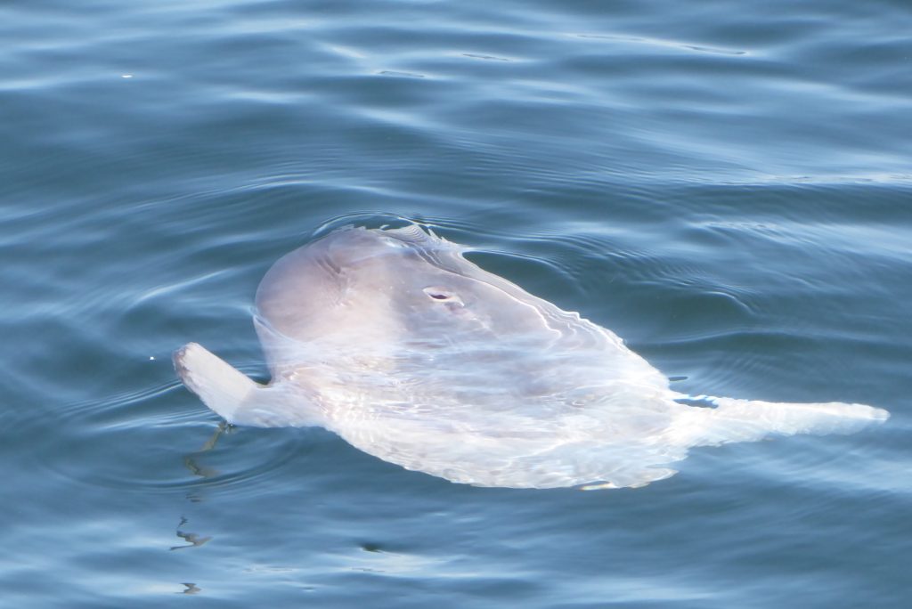
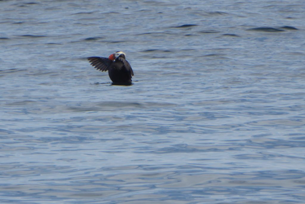
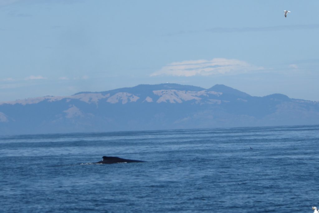
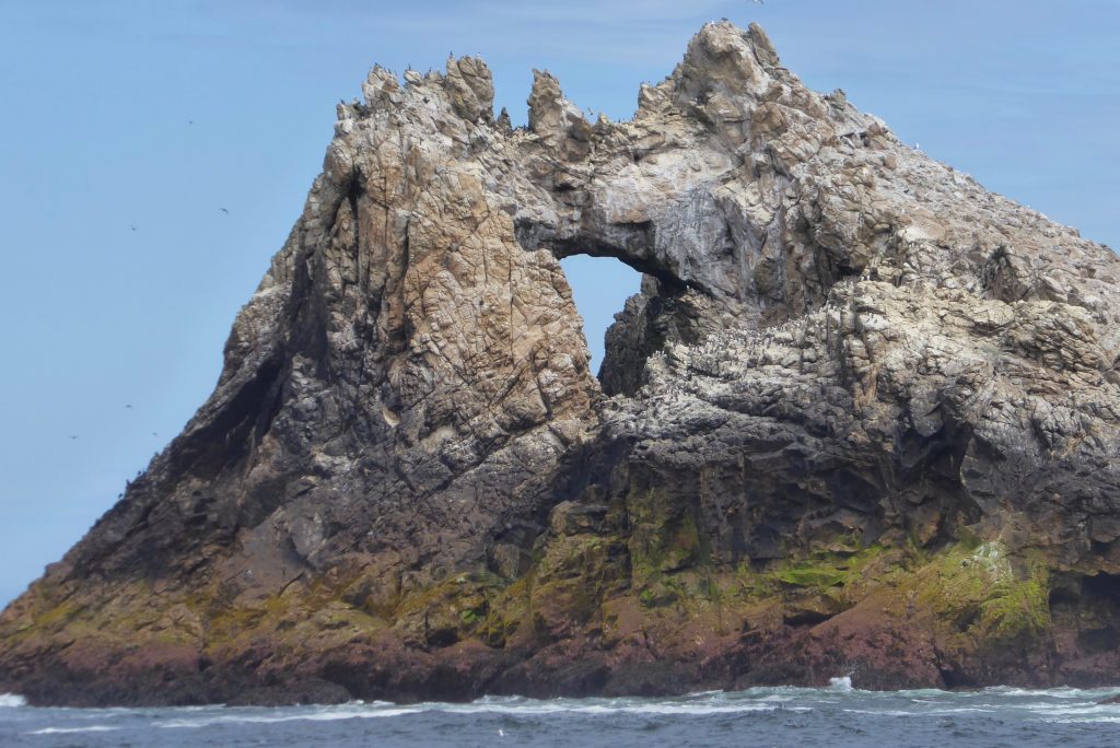
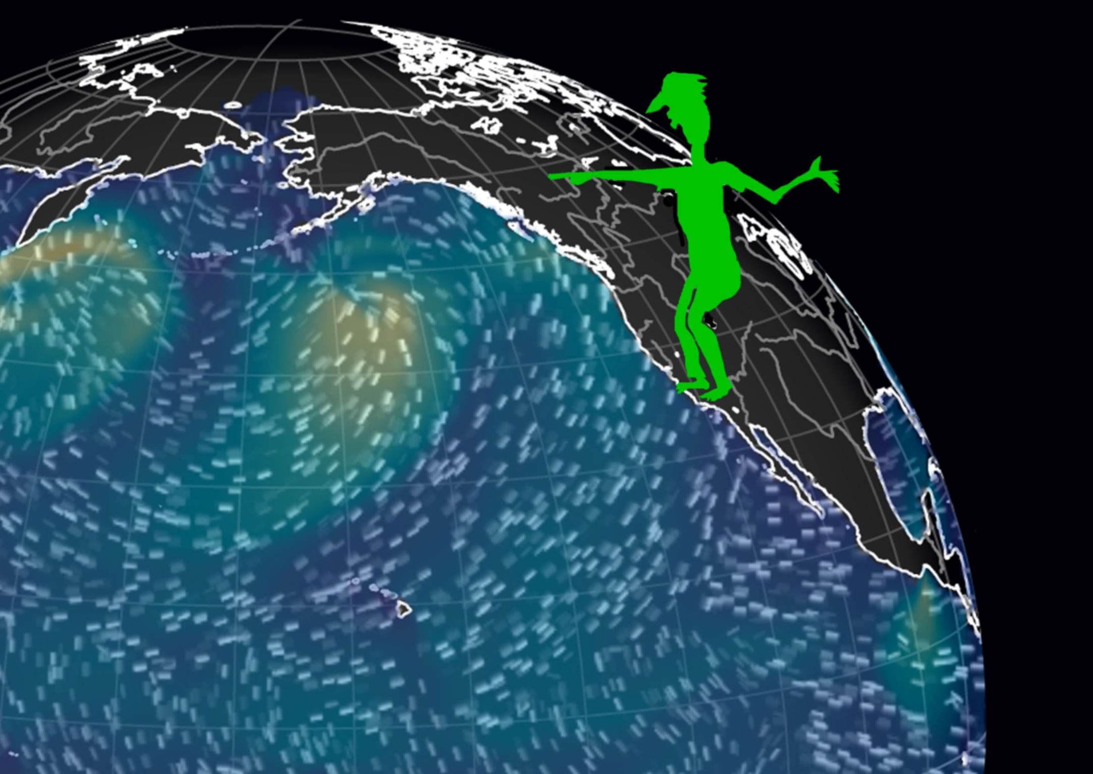
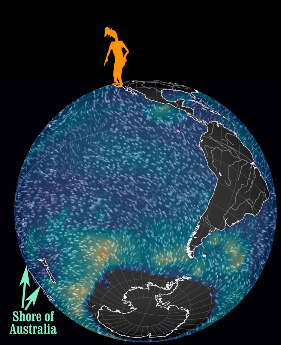
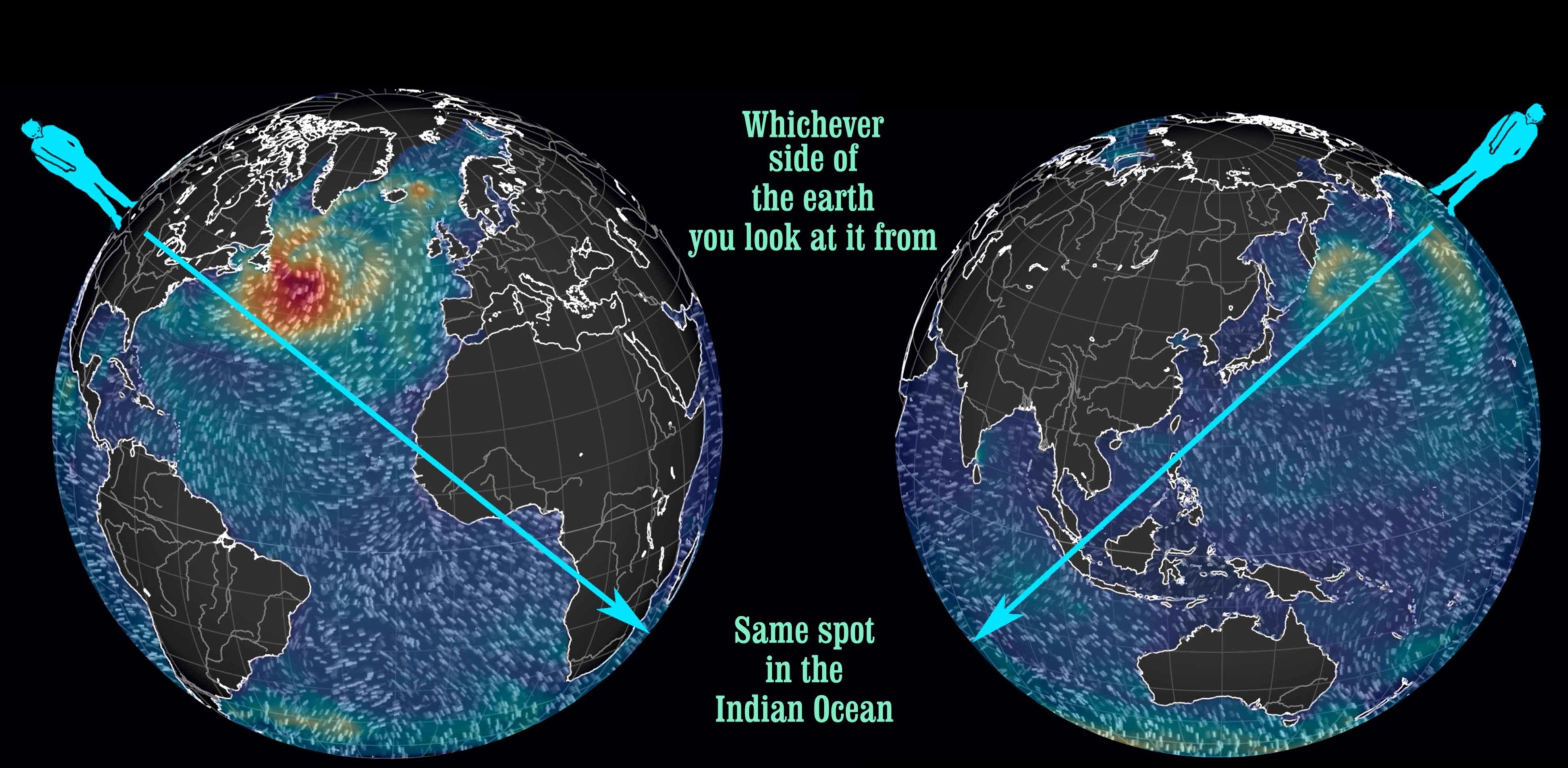
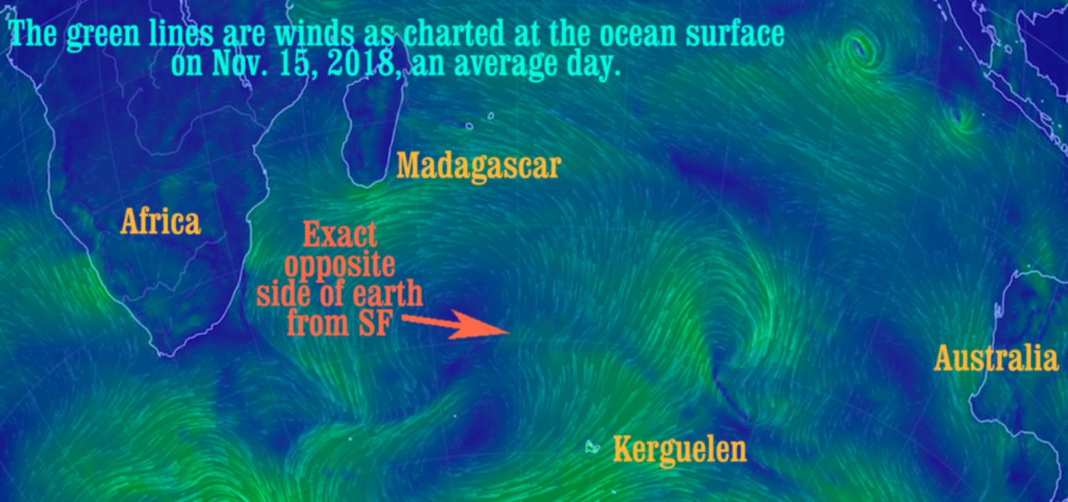
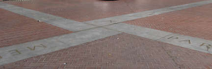

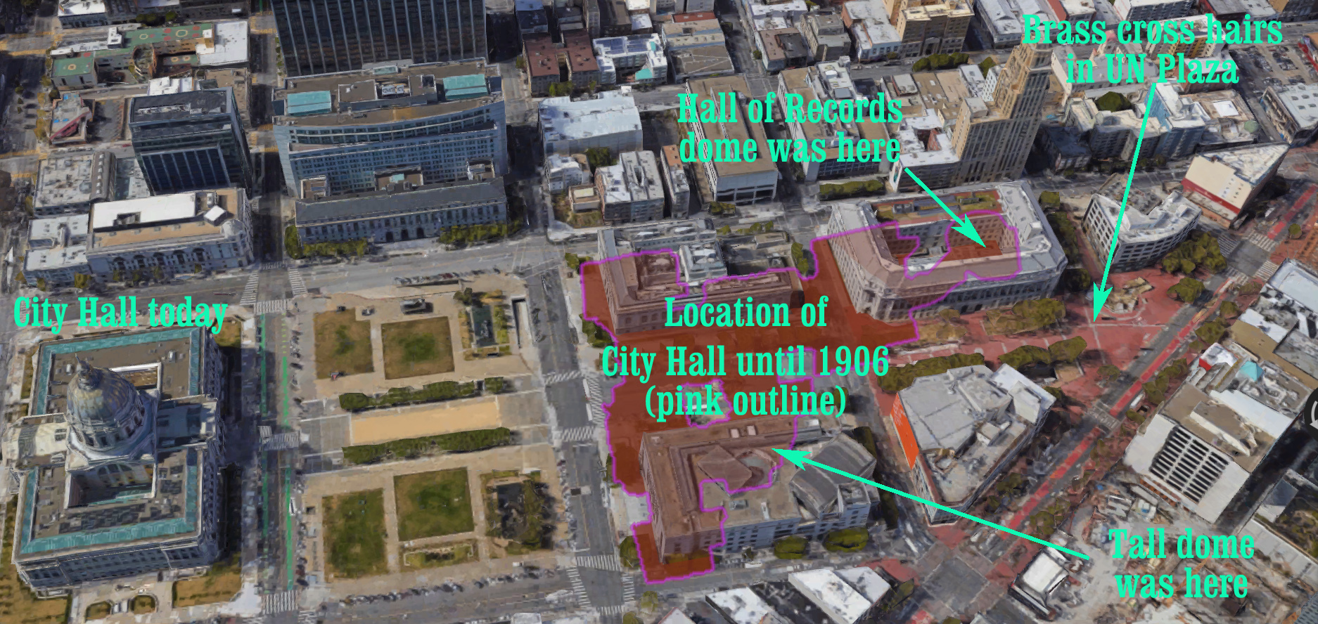
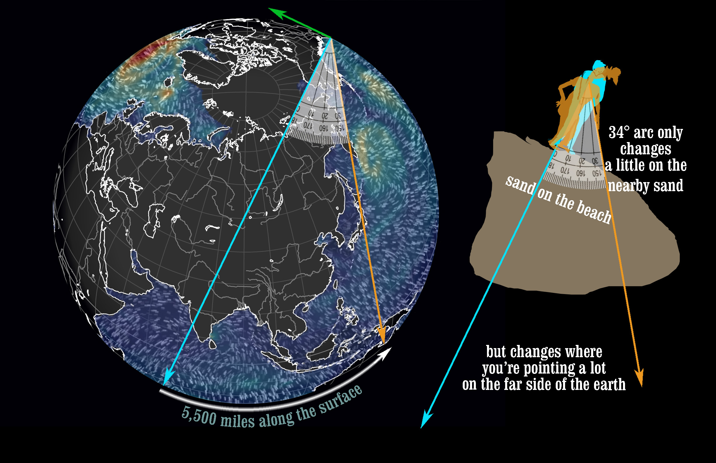
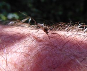

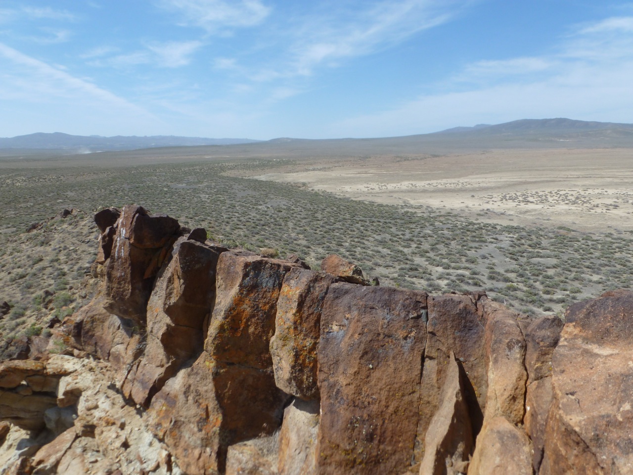
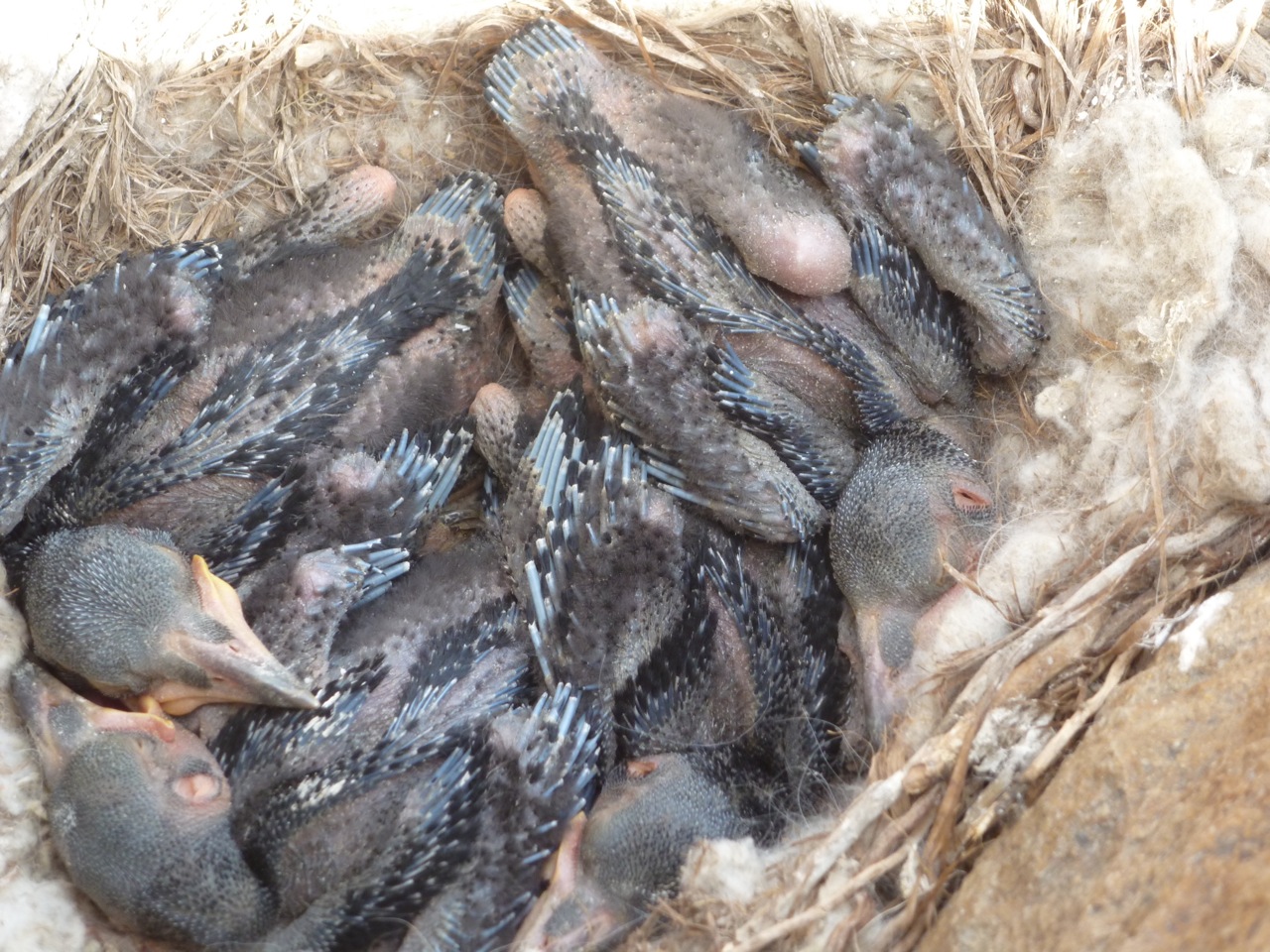
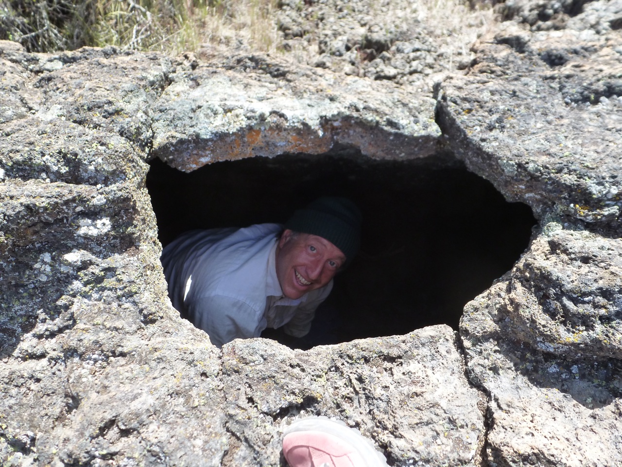
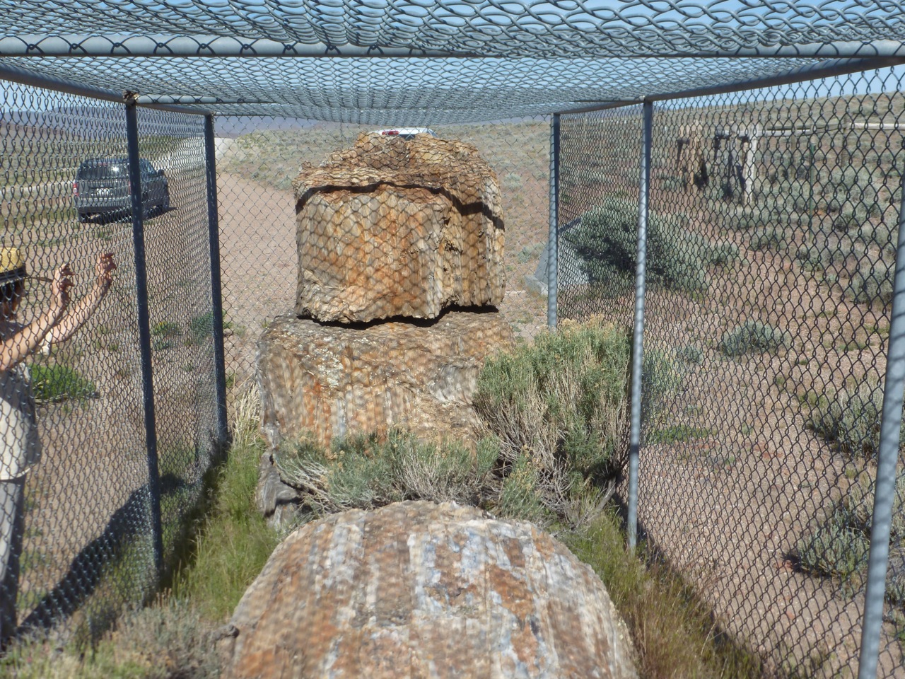
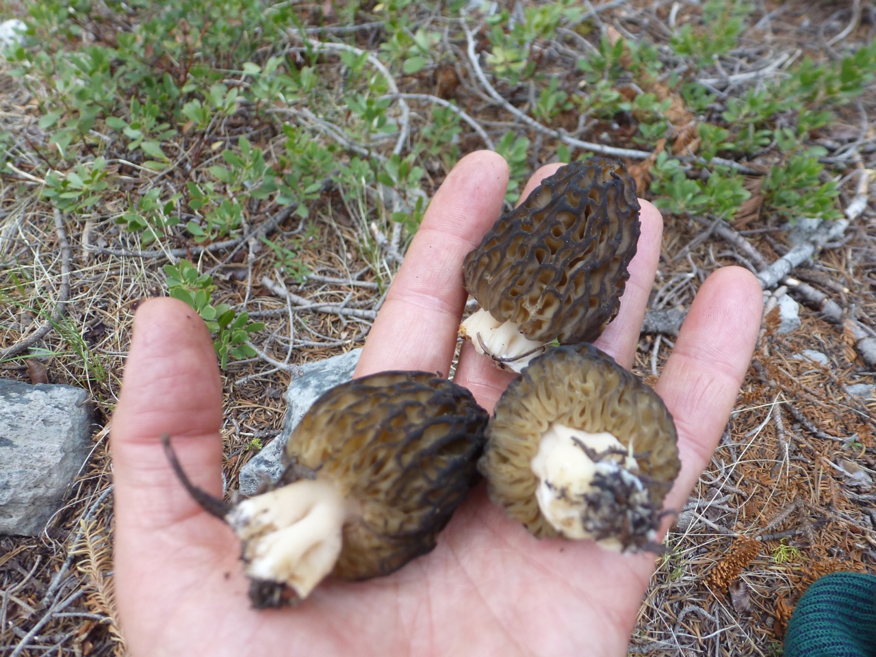
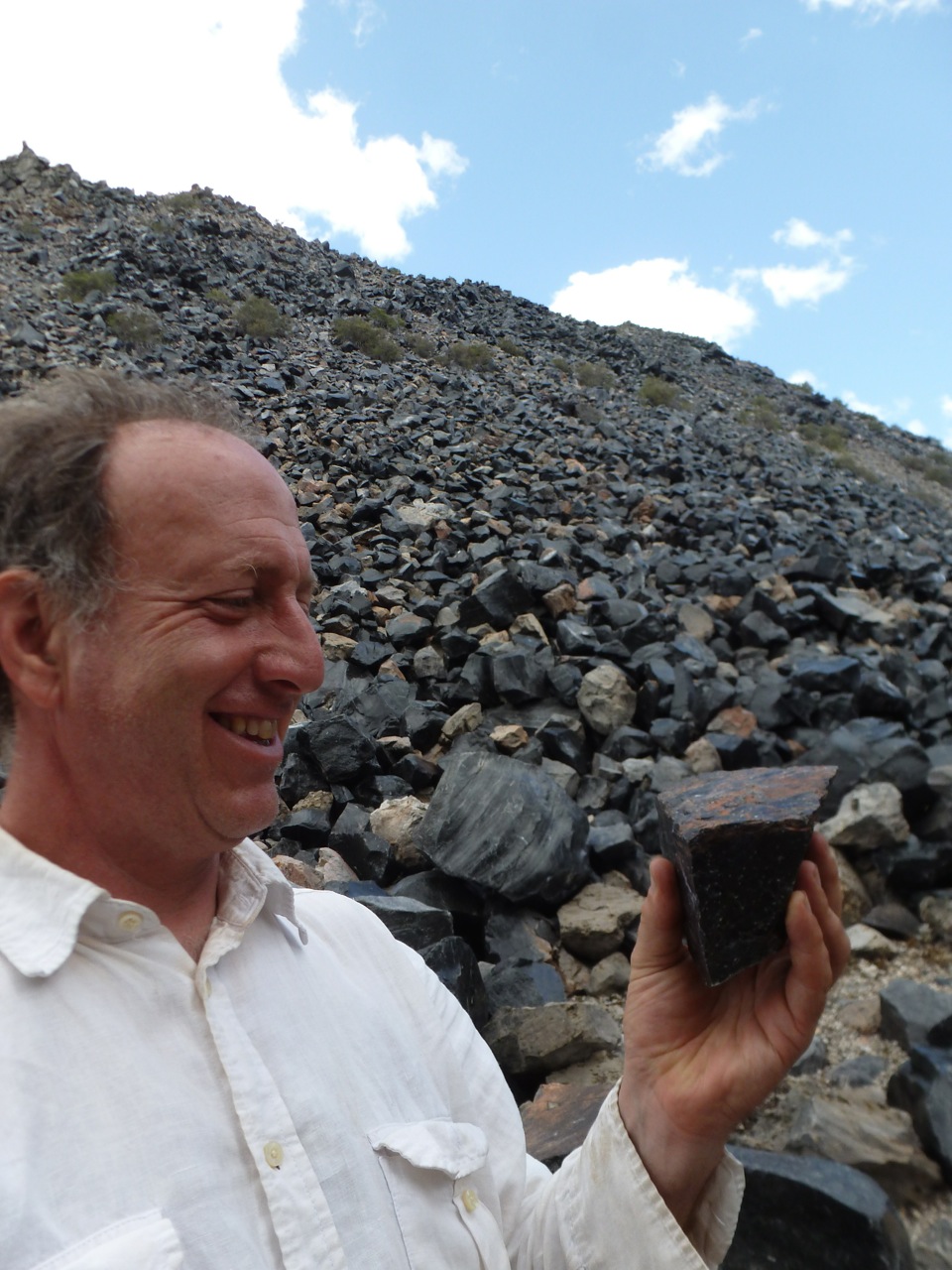
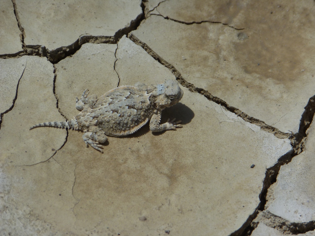
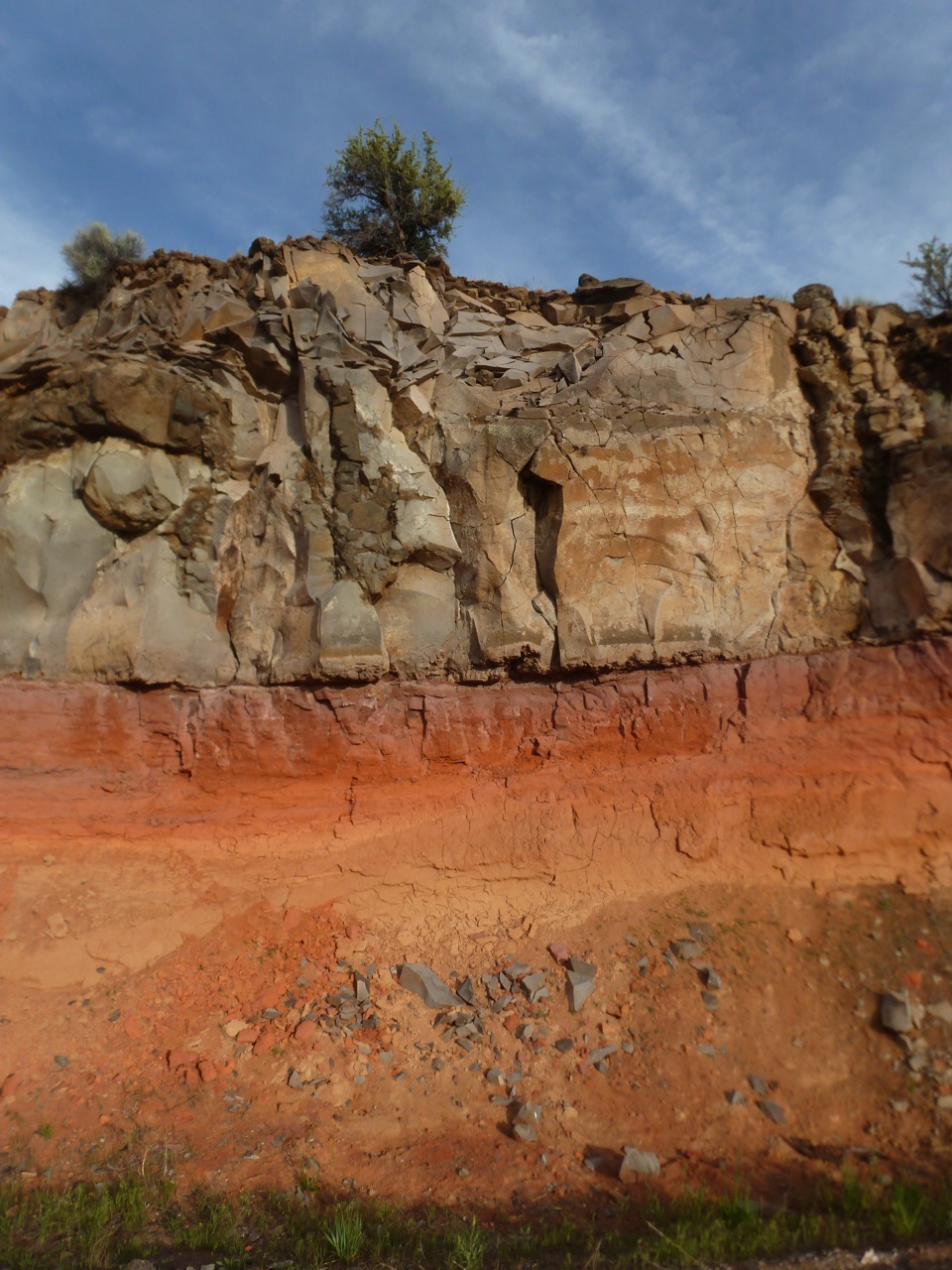
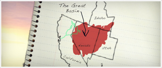
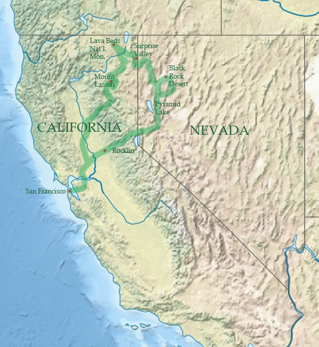
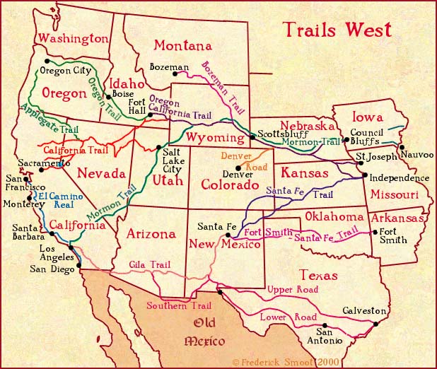
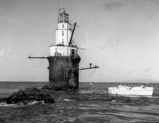
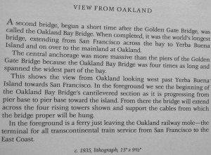
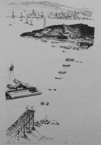
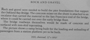
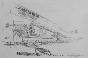
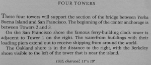
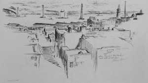
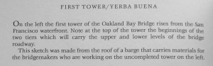

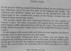
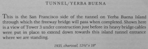
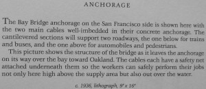
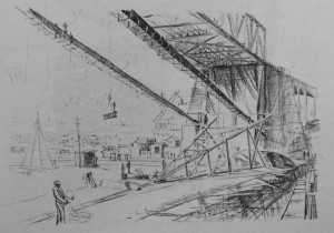
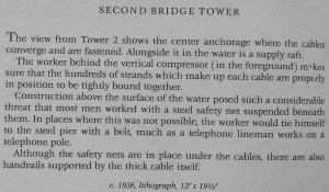
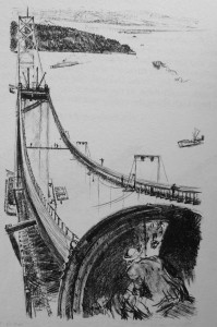
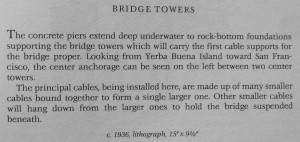
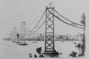
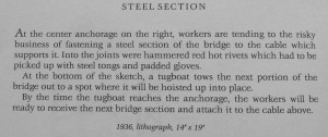
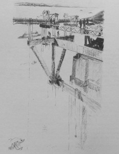

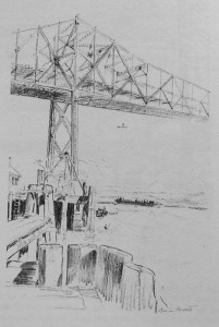


")


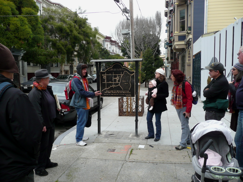
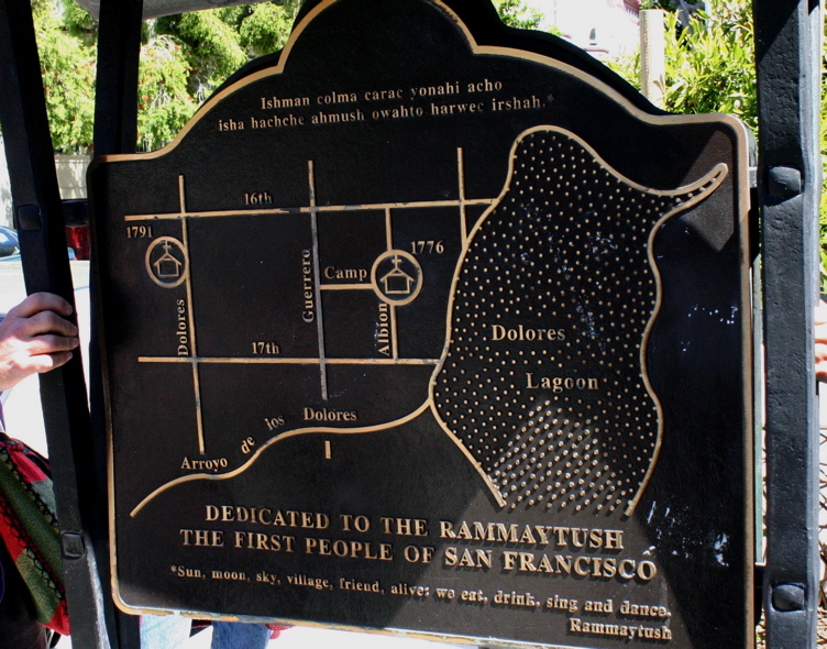